Stampa:Duchy of Warsaw (1812).svg

Size of this PNG preview of this SVG file: 450 × 456 pixels. Riżoluzzjonijiet oħra: 237 × 240 pixels | 474 × 480 pixels | 758 × 768 pixels | 1,011 × 1,024 pixels | 2,021 × 2,048 pixels
Fajl oriġinali (Fajl fil-format SVG, dimensjoni nominali 450 × 456 pixel, dimensjoni tal-fajl: 585 KB)
| Dan huwa fajl mill-Wikimedia Commons. Il-deskrizzjoni fuq il-paġna ta' diskussjoni oriġinali tidher hawn taħt.
|
Taqsira


.svg)
.svg)
.svg)
.svg)
.svg)


.svg)
.svg)
.svg)


.png)
.png)


.svg)


.svg)

.svg)


.svg)
.svg)
.svg)
.svg)


.svg)
.png)


.svg)


.svg)
.svg)


.svg)


.svg)


.svg)
.svg)
.svg)
.svg)
.svg)
.svg)
.svg)
.svg)
_cropped.svg)
.svg)
.svg)
.svg)
.svg)
.svg)
.svg)
.svg)
.svg)
.svg)
.svg)
.svg)
.svg)
.svg)
.svg)
.svg)
.svg)
.svg)
.svg)
.svg)
.svg)
.svg)
.svg)
.svg)
.svg)
.svg)
.svg)
.svg)
.svg)
.svg)
.svg)
.svg)
.svg)
.svg)
.svg)
.svg)
.svg)
.svg)
.svg)
.svg)
.svg)
.svg)
.svg)
.svg)
.svg)
.svg)
Kronoloġija tal-fajl
Agħfas fuq il-grupp data/ħin biex tara l-fajl biex tara kif jidher dak il-ħin.
| Data/Ħin | Minjatura | Qisien | Utent | Kumment | |
|---|---|---|---|---|---|
| kurrenti | 15:05, 5 Ottubru 2013 | | 450 × 456 (585 KB) | TRAJAN 117 | Updated |
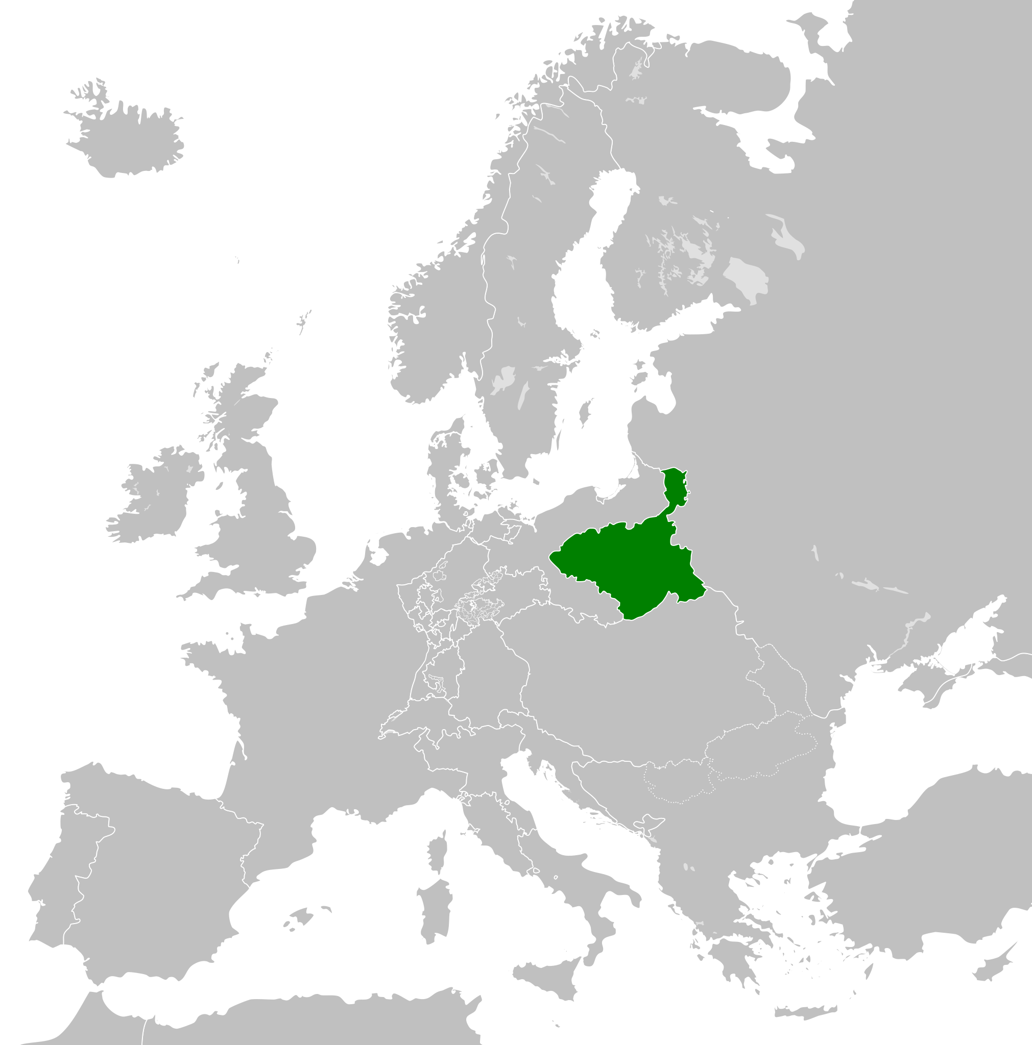
| 07:34, 24 Novembru 2012 |  | 450 × 456 (449 KB) | TRAJAN 117 | {{Information |Description ={{en|1=The Duchy of Warsaw in 1812.}} |Source ={{own}} {{AttribSVG|First French Empire 1812.svg|Alphathon}} |Author =TRAJAN 117 {{created with Inkscape}} |Date =2012-11-24 |Pe... |
Użu tal-fajl
Il-Paġna segwenti twassal għal din l-istampa:
L-użu globali tal-fajl
Il-wikis segwenti jużaw dan il-fajl:
- Użu fuq ar.wikipedia.org
- Użu fuq ast.wikipedia.org
- Użu fuq azb.wikipedia.org
- Użu fuq az.wikipedia.org
- Użu fuq ba.wikipedia.org
- Użu fuq bg.wikipedia.org
- Użu fuq cs.wikipedia.org
- Użu fuq de.wikipedia.org
- Użu fuq dsb.wikipedia.org
- Użu fuq el.wikipedia.org
- Użu fuq en.wikipedia.org
- Użu fuq es.wikipedia.org
- Użu fuq eu.wikipedia.org
- Użu fuq fa.wikipedia.org
- Użu fuq fi.wikipedia.org
- Użu fuq fr.wikipedia.org
- Użu fuq he.wikipedia.org
- Użu fuq hy.wikipedia.org
- Użu fuq id.wikipedia.org
- Użu fuq it.wikipedia.org
- Użu fuq ja.wikipedia.org
- Użu fuq ko.wikipedia.org
- Użu fuq pl.wikipedia.org
- Użu fuq pt.wikipedia.org
- Użu fuq ru.wikipedia.org
- Użu fuq sh.wikipedia.org
- Użu fuq simple.wikipedia.org
- Użu fuq sk.wikipedia.org
- Użu fuq th.wikipedia.org
- Użu fuq tr.wikipedia.org
- Użu fuq uk.wikipedia.org
- Użu fuq www.wikidata.org
- Użu fuq zh-yue.wikipedia.org
- Użu fuq zh.wikipedia.org
.svg)