Stampa:Trinitarian Church of Bratislava (10267484535).jpg
Daqs tad-dehra proviżorja: 800 × 531 pixels. Riżoluzzjonijiet oħra: 320 × 213 pixels | 640 × 425 pixels | 1,024 × 680 pixels | 1,280 × 850 pixels | 2,560 × 1,700 pixels | 4,288 × 2,848 pixels
Fajl oriġinali (4,288 × 2,848 pixel, dimensjoni: 3.24 MB, tip ta' MIME: image/jpeg)
| Dan huwa fajl mill-Wikimedia Commons. Il-deskrizzjoni fuq il-paġna ta' diskussjoni oriġinali tidher hawn taħt.
|
.jpg)
Taqsira
| Deskrizzjoni |
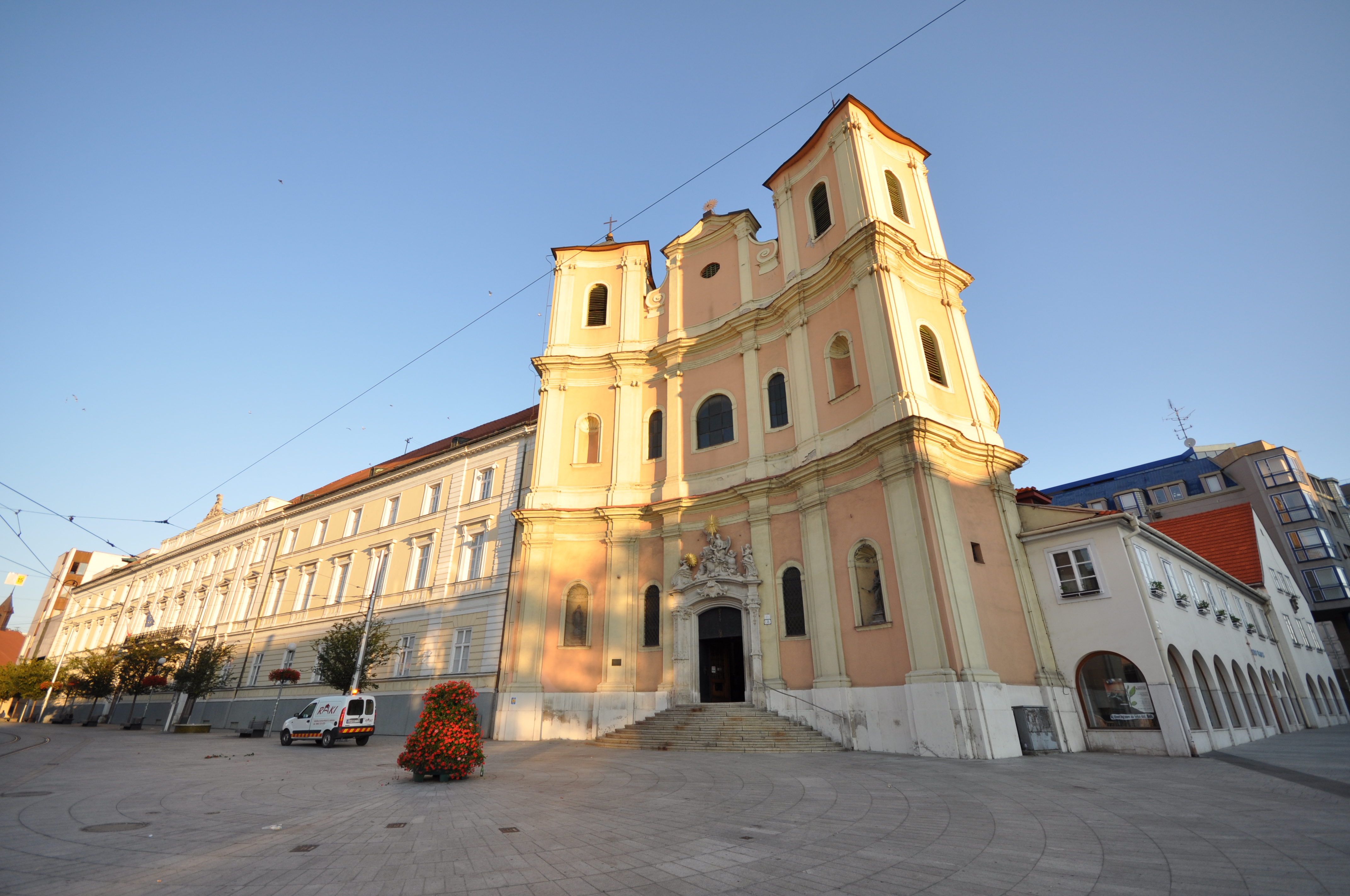
The Trinitarian Church or Trinity Church, full name Church of Saint John of Matha and Saint Felix of Valois (Slovak: Kostol trinitárov, Trinitársky kostol or Trojičný kostol or Kostol svätého Jána z Mathy a svätého Felixa z Valois; incorrectly Holy Trinity Church (Kostol Najsvätejšej Trojice)), is a Baroque-style church in Bratislava's Old Town borough, on the Župné námestie square. The church was built on the site of the older Church of St. Michael, which was demolished in 1529, along with the settlement of St. Michael, during the Ottoman wars, along with other suburbs, so as to see better the attacking Turks. The Trinitarian Order started construction of the church in 1717 and it was sanctified in 1727, although work in the interior continued into the first half of the 18th century [Wikipedia.org] |
| Data | |
| Sors | Trinitarian Church of Bratislava |
| Awtur | Jorge Láscar from Australia |
| Camera location | | View this and other nearby images on: OpenStreetMap |
|---|
.jpg¶ms=048.146111_N_0017.106667_E_globe:Earth_type:camera_source:Flickr_&language=mt)
Liċenzja
Dan il-fajl huwa liċenzjat taħt it-termini tal-liċenzja Creative Commons Attribuzzjoni 2.0 Ġeneriku
- Inti ħieles:
- li taqsam – li tikkopja, tiddistribwixxi u tittrażmetti din l-opra
- li timmodifika – li tadatta l-biċċa xogħol
- Taħt il-kundizzjonijiet segwenti:
- attribuzzjoni – Għandek tattribwixxi x-xogħol bil-mod speċifikat mill-awtur jew minn min ta l-l-iċenzja (imma mhux b'xi mod li jissuġġerixxi ji jappoġjaw lilek jew l-użu tax-xogħol).
| This image was originally posted to Flickr by Jorge Lascar at https://www.flickr.com/photos/8721758@N06/10267484535. It was reviewed on 2 April 2014 by FlickreviewR and was confirmed to be licensed under the terms of the cc-by-2.0. |
Kronoloġija tal-fajl
Agħfas fuq il-grupp data/ħin biex tara l-fajl biex tara kif jidher dak il-ħin.
| Data/Ħin | Minjatura | Qisien | Utent | Kumment | |
|---|---|---|---|---|---|
| kurrenti | 06:34, 2 April 2014 | | 4,288 × 2,848 (3.24 MB) | Russavia | Transferred from Flickr |
Użu tal-fajl
Il-Paġna segwenti twassal għal din l-istampa:
L-użu globali tal-fajl
Il-wikis segwenti jużaw dan il-fajl:
- Użu fuq diq.wikipedia.org
- Użu fuq el.wikipedia.org
- Użu fuq en.wikipedia.org
- Użu fuq fy.wikipedia.org
- Użu fuq hi.wikipedia.org
- Użu fuq id.wikipedia.org
- Użu fuq it.wikipedia.org
- Użu fuq simple.wikipedia.org
- Użu fuq ur.wikipedia.org
- Użu fuq vi.wikipedia.org
.jpg)