Stampa:Top of Halti fjeld - Finland - 07-09-2006.jpg
Daqs tad-dehra proviżorja: 517 × 599 pixels. Riżoluzzjonijiet oħra: 207 × 240 pixels | 414 × 480 pixels | 662 × 768 pixels | 883 × 1,024 pixels | 2,109 × 2,445 pixels
Fajl oriġinali (2,109 × 2,445 pixel, dimensjoni: 1.18 MB, tip ta' MIME: image/jpeg)
| Dan huwa fajl mill-Wikimedia Commons. Il-deskrizzjoni fuq il-paġna ta' diskussjoni oriġinali tidher hawn taħt.
|
Taqsira
| Camera location | | View this and other nearby images on: OpenStreetMap |
|---|
| Deskrizzjoni |
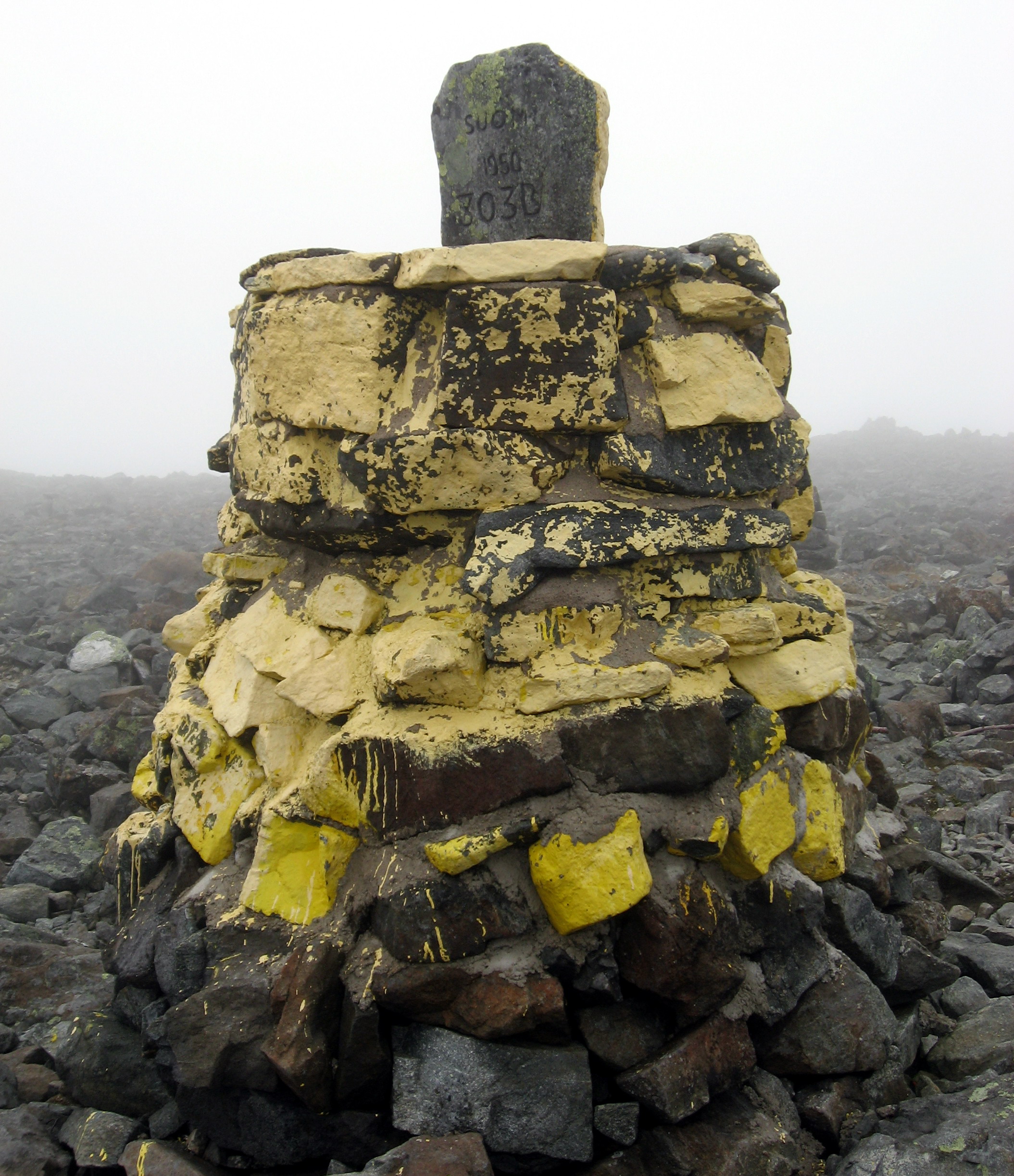
Suomi: Rajapyykki 303B Suomen korkeimmalla kohdalla Haltin rinteellä.
Русский: Знак на склоне сопки Халти (Халтиа, Халтитунтури) - самое высокое место на территории Финляндии. |
| Data | |
| Sors | Opra proprja |
| Awtur | Ppntori |
Liċenzja
| I, the copyright holder of this work, release this work into the public domain. This applies worldwide. In some countries this may not be legally possible; if so: I grant anyone the right to use this work for any purpose, without any conditions, unless such conditions are required by law. |
Kronoloġija tal-fajl
Agħfas fuq il-grupp data/ħin biex tara l-fajl biex tara kif jidher dak il-ħin.
| Data/Ħin | Minjatura | Qisien | Utent | Kumment | |
|---|---|---|---|---|---|
| kurrenti | 18:57, 11 Ottubru 2006 | | 2,109 × 2,445 (1.18 MB) | Ppntori | Category:Geography of Finland |
Użu tal-fajl
Il-Paġna segwenti twassal għal din l-istampa:
L-użu globali tal-fajl
Il-wikis segwenti jużaw dan il-fajl:
- Użu fuq ami.wikipedia.org
- Użu fuq bg.wikipedia.org
- Użu fuq ceb.wikipedia.org
- Użu fuq cs.wikipedia.org
- Użu fuq da.wikipedia.org
- Użu fuq en.wikipedia.org
- Użu fuq en.wikivoyage.org
- Użu fuq es.wikipedia.org
- Użu fuq et.wikipedia.org
- Użu fuq eu.wikipedia.org
- Użu fuq fi.wikipedia.org
- Użu fuq gl.wikipedia.org
- Użu fuq he.wikipedia.org
- Użu fuq it.wikipedia.org
- Użu fuq ja.wikipedia.org
- Użu fuq ko.wikipedia.org
- Użu fuq lmo.wikipedia.org
- Użu fuq lt.wikipedia.org
- Użu fuq nl.wikipedia.org
- Użu fuq nn.wikipedia.org
- Użu fuq no.wikipedia.org
- Użu fuq pl.wikipedia.org
- Użu fuq pt.wikipedia.org
- Użu fuq ro.wikipedia.org
- Użu fuq ru.wikipedia.org
- Użu fuq sk.wikipedia.org
- Użu fuq sl.wikipedia.org
- Użu fuq sv.wikipedia.org
- Użu fuq sw.wikipedia.org
- Użu fuq tr.wikipedia.org
- Użu fuq udm.wikipedia.org
- Użu fuq uk.wikipedia.org
- Użu fuq uz.wikipedia.org
- Użu fuq zh.wikipedia.org