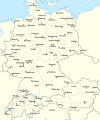
Stampa:Rzeczpospolita 1937.svg

Fajl oriġinali(Fajl fil-format SVG, dimensjoni nominali 2,220 × 1,554 pixel, dimensjoni tal-fajl: 573 KB)

Dan huwa fajl mill-Wikimedia Commons. Il-deskrizzjoni fuq il-paġna ta' diskussjoni oriġinali tidher hawn taħt.
Commons huwa repożitorju ta' fajls multimedjali liċenzjati b'xejn. Int tista' tgħin.

Taqsira

Deskrizzjoni Test version of a vectorized File:Rzeczpospolita 1920.png; more changes will follow, only checking if wiki displays it right
Data
Sors

Opra proprja; based on an earlier raster map made in 2005, as well as similar maps made by myself in 2004 (see below).
In preparation of this map I used many other maps as sources and backup. Among them were:

  • a German roadmap of Poland printed in 1938 (colours and the shape of East Prussian border)
  • and perhaps a dozen others.
Awtur Halibutt
Verżjonijiet oħra
SVG genesis
InfoField
 
The source code of this SVG is invalid due to 2 errors.
 
This W3C-invalid map was created with Adobe Illustrator,
 
and with Inkscape.
 
 This map uses embedded text that can be easily translated using a text editor.


Copyright notice: Image made by Halibutt and uploaded to Wikipedia by the author. Images can be made available for use under other copyleft licenses on a case by case basis via direct contact with the author. Under moral rights the user requires that this work be properly attributed to its creator. For photographs, this is traditionally done in the image caption. Where a copyright notice is present, using the copyright notice in the caption will be sufficient. Note that the GFDL requires that any copyright notices be included with the work even when making unmodified use of it.

Since the legal status of the above comment has been questioned, I hereby grant anyone the right to treat it as either a standard copyright notice, invariant section, legal statement, legal advice, friendly suggestion or a mere comment, depending on his or hers own choice.
Halibutt
GNU head Huwa permess li tikkopja, tiddistribwixxi u/jew timmodifika dan id-dokument abbażi tat-termini tal-Liċenzja ta' Dokumentazzjoni Ħielsa tal-GNU, Verżjoni 1.2 jew kwalunkwe verżjoni oħra pubblikata mill-Free Software Foundation; mingħajr ebda sezzjoni non-modifikabbli, mingħajr test tal-faċċata u mingħajr test tal-qoxra. Kopja tal-liċenzja hi inkluża fis-sezzjoni intitolata Test tal-Liċenzja ta' Dokumentazzjoni Ħielsa tal-GNU".
w:mt:Creative Commons
attribuzzjoni Ixxerja bl-istess mod
Dan il-fajl huwa liċenzjat taħt it-termini tal-liċenzja Creative Commons Attribuzzjoni-Aqsam bl-istess mod 3.0 Unported
Inti ħieles:
  • li taqsam – li tikkopja, tiddistribwixxi u tittrażmetti din l-opra
  • li timmodifika – li tadatta l-biċċa xogħol
Taħt il-kundizzjonijiet segwenti:
  • attribuzzjoni – Għandek tattribwixxi x-xogħol bil-mod speċifikat mill-awtur jew minn min ta l-l-iċenzja (imma mhux b'xi mod li jissuġġerixxi ji jappoġjaw lilek jew l-użu tax-xogħol).
  • Ixxerja bl-istess mod – Jekk tbiddel, tittrasforma jew tibni fuq dan il-materjal, inti għandek bżonn taqsam il-kontribuzzjonijiet tiegħek taħt l-istess liċenzja jew waħda li taqbel ma' dik oriġinali.
This licensing tag was added to this file as part of the GFDL licensing update.

The following is a list of maps created by Halibutt and uploaded to commons, as well as their present and projected derivatives.

Parent Image Image Description
  Maps by Halibutt
Image:Rzeczpospolita.png Image:Rzeczpospolita.png The Republic in 17th and 18th century
Image:Rzeczpospolita 1600.png The Republic after the Treaty of Dywilino
Image:Rzeczpospolita voivodships.png Voivodships of The Republic
Image:Rzeczpospolita_Potop.png The Republic during The Deluge and Chmielnicki Uprising, with major battles of the era marked
Magnates and their lands and domains
1st2nd3rd Partitions of Poland
War of the constitution
Image:Rzeczpospolita.xcf SOURCE FILE - GIMP format
Image:Poland 1939.png Image:Poland 1939.png Poland in 1939
Image:Dywizje wrzesien 1.png Order of Battle on September 1st, during the Polish Defence War of 1939
Image:Poland 1939.xcf SOURCE FILE - GIMP format
Image:Polska kontur bialy.png Image:Polska kontur bialy.png Contour map of Poland AD 1999, for use with various locator maps
Image:Rzeczpospolita 1923.png Image:Rzeczpospolita 1923.png Map of Poland 1918-1939, currently under development
Image:PBW March 1919.png Polish-Bolshevik War - fronts in March of 1919
Image:PBW December 1919.png Polish-Bolshevik War - fronts in December of 1919
Image:PBW June 1920.png Polish-Bolshevik War - fronts in July of 1920
Image:PBW August 1920.png Polish-Bolshevik War - fronts in August of 1920
Polish Defence War of 1939
Polish areas annexed by Germany, Lithuania, Slovakia and the Soviet Union
German concentration camps in Poland
Curzon line
Major battles of the Polish-Bolshevik War
namesno names Polish/Czechoslovak/Lithuanian/German/Ukrainian claims in 1920's
Image:Rzeczpospolita Central Lithuania.png Central Lithuania
Image:Rzeczpospolita Lithuania claims.png Central Lithuania as compared with other Lithuanian claims
Image:Rzeczpospolita 1789-1920.png Post-1922 borders compared with the territory of Poland before the partitions
Warsaw Uprising and the Operation Tempest
Poland partitioned between the Soviets and the Germans
Image:Rzeczpospolita 1939 Polish divisions.png Polish divisions on September 1, 1939
Home Army inspectorates
Image:Rzeczpospolita 1922.xcf SOURCE FILE - GIMP format
Image:Rzeczpospolita 1937.svg Vector version!!!! layered version available on request

Captions

Add a one-line explanation of what this file represents

Items portrayed in this file

depicts Ingliż

copyrighted Ingliż

11 Marzu 2008

Kronoloġija tal-fajl

Agħfas fuq il-grupp data/ħin biex tara l-fajl biex tara kif jidher dak il-ħin.

(L-aħħar | L-ewwel) Ara (10 l-aktar riċenti | ) (10 | 20 | 50 | 100 | 250 | 500)
Data/ĦinMinjaturaQisienUtentKumment
kurrenti15:24, 1 Jannar 2017Minjatura tal-verżjoni ta' 15:24, 1 Jannar 20172,220 × 1,554 (573 KB)Sascha GPDMalmö (duplicate) -> Göteborg
14:34, 30 Lulju 2013Minjatura tal-verżjoni ta' 14:34, 30 Lulju 20132,220 × 1,554 (573 KB)HalibuttAdded some rivers in Russia, corrected others (RO, HU, PL)
03:28, 30 Lulju 2013Minjatura tal-verżjoni ta' 03:28, 30 Lulju 20132,220 × 1,563 (458 KB)HalibuttSweden corrected (town names added)
03:16, 30 Lulju 2013Minjatura tal-verżjoni ta' 03:16, 30 Lulju 20132,214 × 1,567 (492 KB)Halibuttcrunched version (deleted background layers)
03:13, 30 Lulju 2013Minjatura tal-verżjoni ta' 03:13, 30 Lulju 20132,214 × 1,567 (3.68 MB)Halibuttlet's see if the expanded version works
18:11, 16 Lulju 2010Minjatura tal-verżjoni ta' 18:11, 16 Lulju 20102,014 × 1,567 (534 KB)HierakaresCorrected position of name Oppeln which was overlapping with point.
08:54, 14 Marzu 2008Minjatura tal-verżjoni ta' 08:54, 14 Marzu 20082,014 × 1,567 (534 KB)HalibuttNames of larger towns enlarged
08:45, 14 Marzu 2008Minjatura tal-verżjoni ta' 08:45, 14 Marzu 20082,014 × 1,567 (533 KB)Halibuttversion corrected by Madman
00:30, 14 Marzu 2008Minjatura tal-verżjoni ta' 00:30, 14 Marzu 20082,000 × 1,534 (512 KB)Halibutt{{Information |Description= |Source=self-made |Date= |Author= Halibutt |Permission= |other_versions= }}
23:54, 13 Marzu 2008Minjatura tal-verżjoni ta' 23:54, 13 Marzu 20082,000 × 1,534 (548 KB)Halibutt{{Information |Description= |Source=self-made |Date= |Author= Halibutt |Permission= |other_versions= }}
(L-aħħar | L-ewwel) Ara (10 l-aktar riċenti | ) (10 | 20 | 50 | 100 | 250 | 500)

Il-Paġna segwenti twassal għal din l-istampa:

L-użu globali tal-fajl

Il-wikis segwenti jużaw dan il-fajl:

Ara l-użu globali ta' dan il-fajl.

Metadati