Stampa:Maloelap&Aur atoll (satellite).jpg
Daqs tad-dehra proviżorja: 800 × 530 pixels. Riżoluzzjonijiet oħra: 320 × 212 pixels | 640 × 424 pixels | 1,024 × 678 pixels | 1,280 × 848 pixels | 3,032 × 2,008 pixels
Fajl oriġinali (3,032 × 2,008 pixel, dimensjoni: 1.2 MB, tip ta' MIME: image/jpeg)
| Dan huwa fajl mill-Wikimedia Commons. Il-deskrizzjoni fuq il-paġna ta' diskussjoni oriġinali tidher hawn taħt.
|
.jpg)
Taqsira
| Deskrizzjoni |
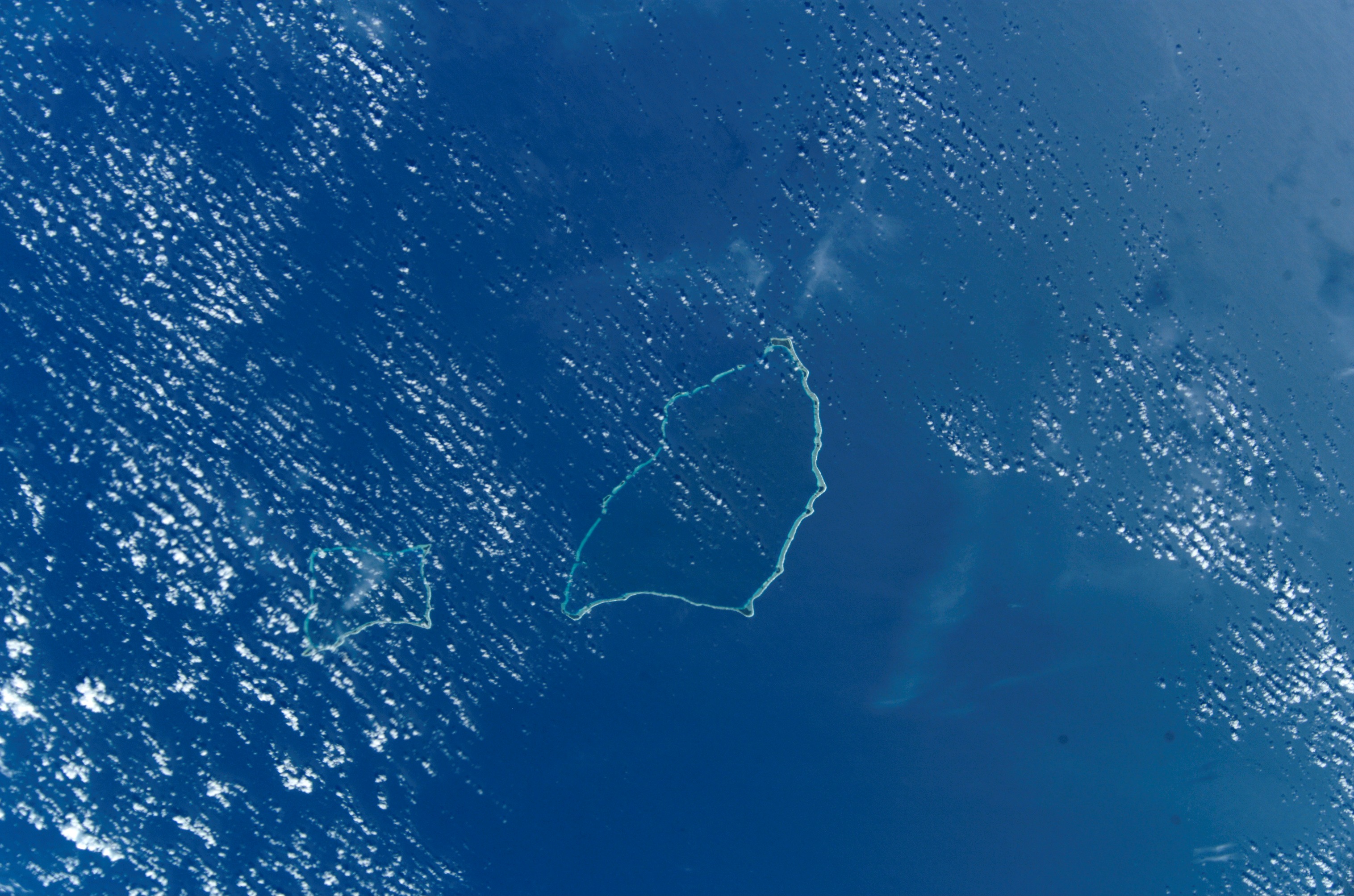
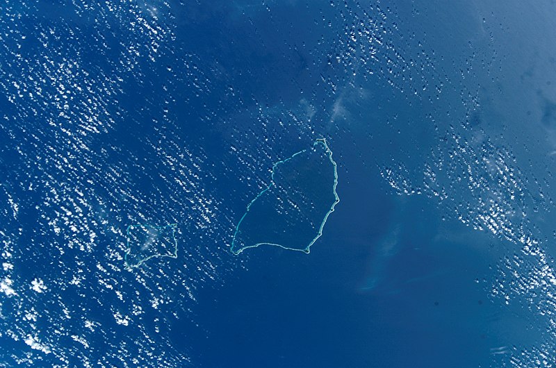
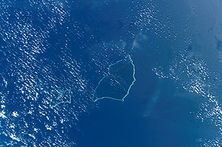
Deutsch: NASA-Astronautenbild der Atolle Maloelap und Aur (Ralik-Kette, Marshallinseln) im Pazifik
English: NASA Astronaut Image of Maloelap & Aur Atoll (Ralik Chain, Marshall Islands) in the Pacific Ocean
Español: Atolón Ailinginae
Русский: Космический снимок НАСА атолла Аилингинаэ (цепь Ралик, Маршалловы острова) в Тихом океане |
| Data | UTC |
| Sors | http://eol.jsc.nasa.gov/scripts/sseop/photo.pl?mission=ISS004&roll=E&frame=10164 |
| Awtur | NASA/JSC |
| Permess (Użu mill-ġdid tal-fajl) |
Conditions of Use of Astronaut Photographs |
This image or video was catalogued by Johnson Space Center of the United States National Aeronautics and Space Administration (NASA) under Photo ID: ISS004-E-10164. This tag does not indicate the copyright status of the attached work. A normal copyright tag is still required. See Commons:Licensing. Other languages:
|
Liċenzja
This file is in the public domain in the United States because it was created by the Image Science & Analysis Laboratory, of the NASA Johnson Space Center. NASA copyright policy states that "NASA material is not protected by copyright unless noted". (NASA media use guidelines or Conditions of Use of Astronaut Photographs).
Photo source: ISS004-E-10164.
|
Kronoloġija tal-fajl
Agħfas fuq il-grupp data/ħin biex tara l-fajl biex tara kif jidher dak il-ħin.
| Data/Ħin | Minjatura | Qisien | Utent | Kumment | |
|---|---|---|---|---|---|
| kurrenti | 18:11, 27 Ottubru 2014 | | 3,032 × 2,008 (1.2 MB) | Ras67 | high res |
| 12:25, 30 Settembru 2005 |  | 639 × 435 (93 KB) | Los688 | Maloelap Atoll.Marshal islands. From http://eol.jsc.nasa.gov/scripts/sseop/photo.pl?mission=ISS004&roll=E&frame=10164&QueryResultsFile=11280825067482.tsv ISS004 mission. Date: 2002:04:19 GMT Time: 22:31:34 Nadir Point Latitude: N13.9, Longitude: E171.1 Ph |
Użu tal-fajl
Il-Paġna segwenti twassal għal din l-istampa:
L-użu globali tal-fajl
Il-wikis segwenti jużaw dan il-fajl:
- Użu fuq ast.wikipedia.org
- Użu fuq ca.wikipedia.org
- Użu fuq ceb.wikipedia.org
- Użu fuq de.wikipedia.org
- Użu fuq en.wikipedia.org
- Użu fuq en.wikivoyage.org
- Użu fuq es.wikipedia.org
- Użu fuq fa.wikipedia.org
- Użu fuq fi.wikipedia.org
- Użu fuq fr.wikipedia.org
- Użu fuq gl.wikipedia.org
- Użu fuq hu.wikipedia.org
- Użu fuq id.wikipedia.org
- Użu fuq it.wikipedia.org
- Użu fuq ja.wikipedia.org
- Użu fuq ko.wikipedia.org
- Użu fuq lt.wikipedia.org
- Użu fuq lv.wikipedia.org
- Użu fuq mk.wikipedia.org
- Użu fuq nn.wikipedia.org
- Użu fuq pl.wikipedia.org
- Użu fuq ru.wikipedia.org
- Użu fuq sv.wikipedia.org
- Użu fuq uk.wikipedia.org
- Użu fuq ur.wikipedia.org
- Użu fuq www.wikidata.org
Ara l-użu globali ta' dan il-fajl.
.jpg)
.jpg)