Stampa:Karst following phosphate mining on Nauru.jpg
Daqs tad-dehra proviżorja: 800 × 535 pixels. Riżoluzzjonijiet oħra: 320 × 214 pixels | 640 × 428 pixels | 1,024 × 684 pixels | 1,280 × 855 pixels | 1,787 × 1,194 pixels
Fajl oriġinali (1,787 × 1,194 pixel, dimensjoni: 835 KB, tip ta' MIME: image/jpeg)
| Dan huwa fajl mill-Wikimedia Commons. Il-deskrizzjoni fuq il-paġna ta' diskussjoni oriġinali tidher hawn taħt.
|
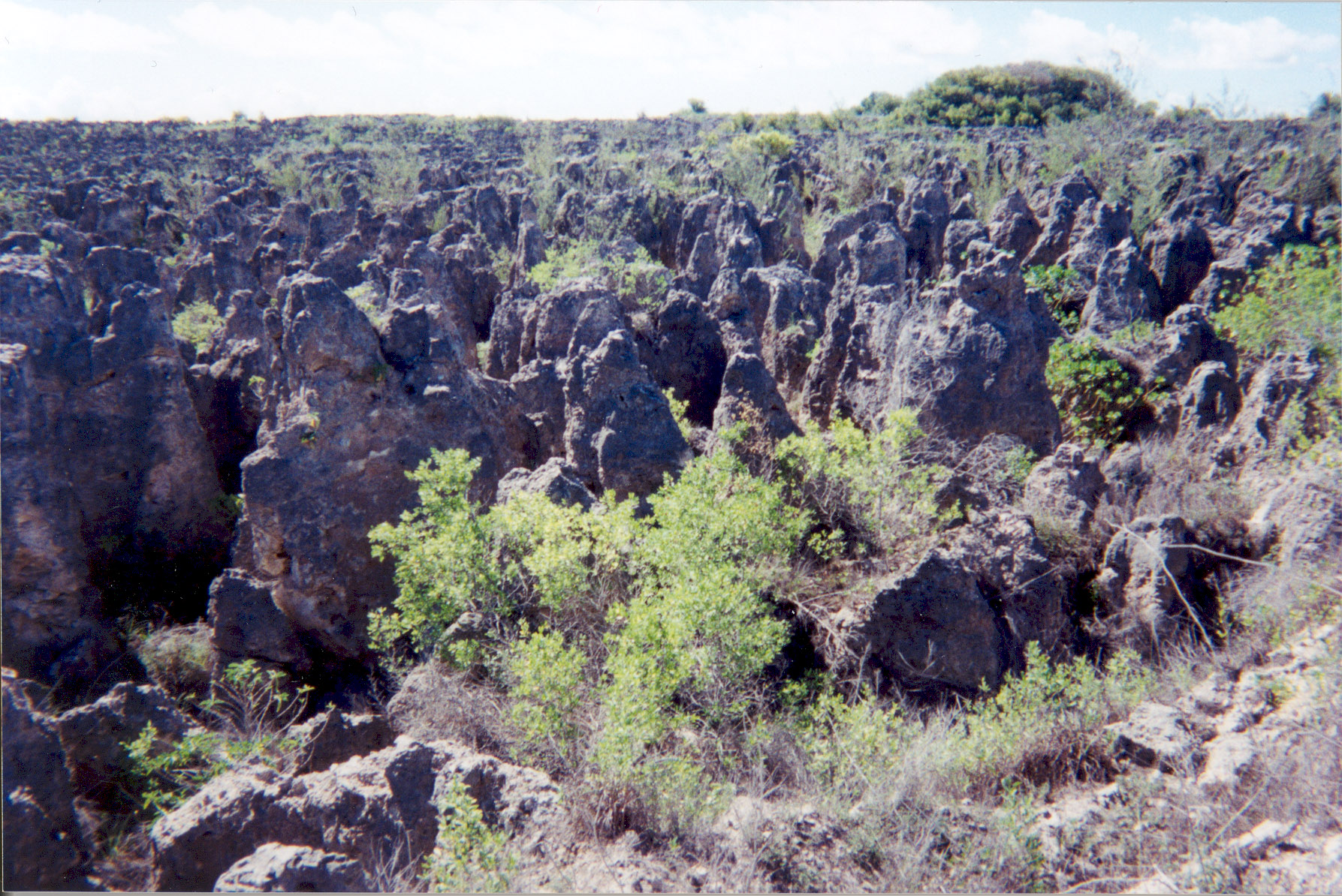
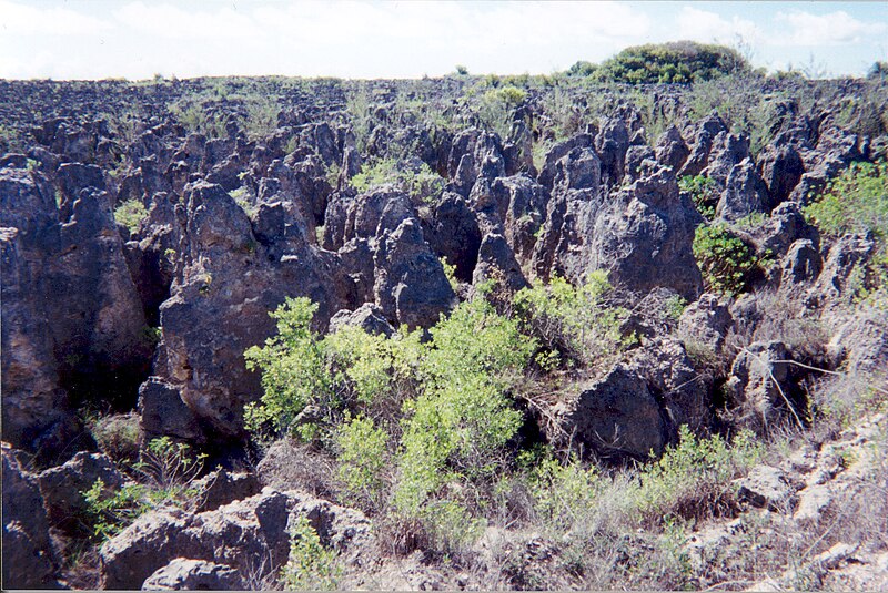
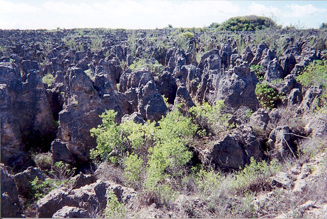
A limestone karst on Nauru Island as a result of the over-mining of phosphate.
Source: [1] (http://www.arm.gov/)
This photograph was produced by the Atmospheric Radiation Measurement Program.
Their site states:
|
Kronoloġija tal-fajl
Agħfas fuq il-grupp data/ħin biex tara l-fajl biex tara kif jidher dak il-ħin.
| Data/Ħin | Minjatura | Qisien | Utent | Kumment | |
|---|---|---|---|---|---|
| kurrenti | 02:10, 3 April 2007 | | 1,787 × 1,194 (835 KB) | Indolences | |
| 05:21, 5 Mejju 2006 |  | 480 × 321 (75 KB) | PDH | Nauruan districts of Denigomodu and Nibok. ''Courtesy: U.S. Department of Energy's Atmospheric Radiation Measurement Program.'' Source: [http://images.arm.gov/armimages.nsf/a89ad461c472386388256cf3007aeb57/500d8248a90eea9488256cc400727e96?OpenDocument&H |
Użu tal-fajl
Il-Paġna segwenti twassal għal din l-istampa:
L-użu globali tal-fajl
Il-wikis segwenti jużaw dan il-fajl:
- Użu fuq az.wikipedia.org
- Użu fuq bg.wikipedia.org
- Użu fuq bh.wikipedia.org
- Użu fuq ca.wikipedia.org
- Użu fuq de.wikipedia.org
- Użu fuq el.wikipedia.org
- Użu fuq en.wikipedia.org
- Użu fuq en.wikiquote.org
- Użu fuq eo.wikipedia.org
- Użu fuq es.wikipedia.org
- Użu fuq eu.wikipedia.org
- Użu fuq fa.wikipedia.org
- Użu fuq fr.wikipedia.org
- Użu fuq ha.wikipedia.org
- Użu fuq he.wikipedia.org
- Użu fuq id.wikipedia.org
- Użu fuq ig.wikipedia.org
- Użu fuq ja.wikipedia.org
- Użu fuq mk.wikipedia.org
- Użu fuq na.wikipedia.org
- Użu fuq new.wikipedia.org
- Użu fuq pl.wikipedia.org
- Użu fuq pt.wikipedia.org
- Użu fuq ro.wikipedia.org
- Użu fuq ru.wikipedia.org
- Użu fuq si.wikipedia.org
- Użu fuq sv.wikipedia.org
- Użu fuq tr.wikipedia.org
- Użu fuq uk.wikipedia.org
- Użu fuq vi.wikipedia.org
Ara l-użu globali ta' dan il-fajl.