Stampa:Gulf of Thailand.svg

Size of this PNG preview of this SVG file: 488 × 479 pixels. Riżoluzzjonijiet oħra: 245 × 240 pixels | 489 × 480 pixels | 782 × 768 pixels | 1,043 × 1,024 pixels | 2,086 × 2,048 pixels
Fajl oriġinali (Fajl fil-format SVG, dimensjoni nominali 488 × 479 pixel, dimensjoni tal-fajl: 387 KB)
| Dan huwa fajl mill-Wikimedia Commons. Il-deskrizzjoni fuq il-paġna ta' diskussjoni oriġinali tidher hawn taħt.
|
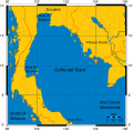
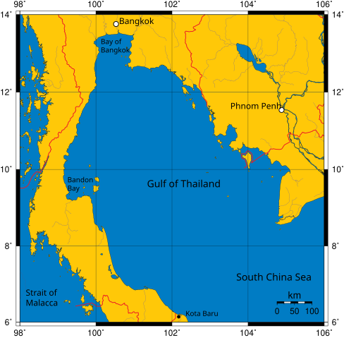
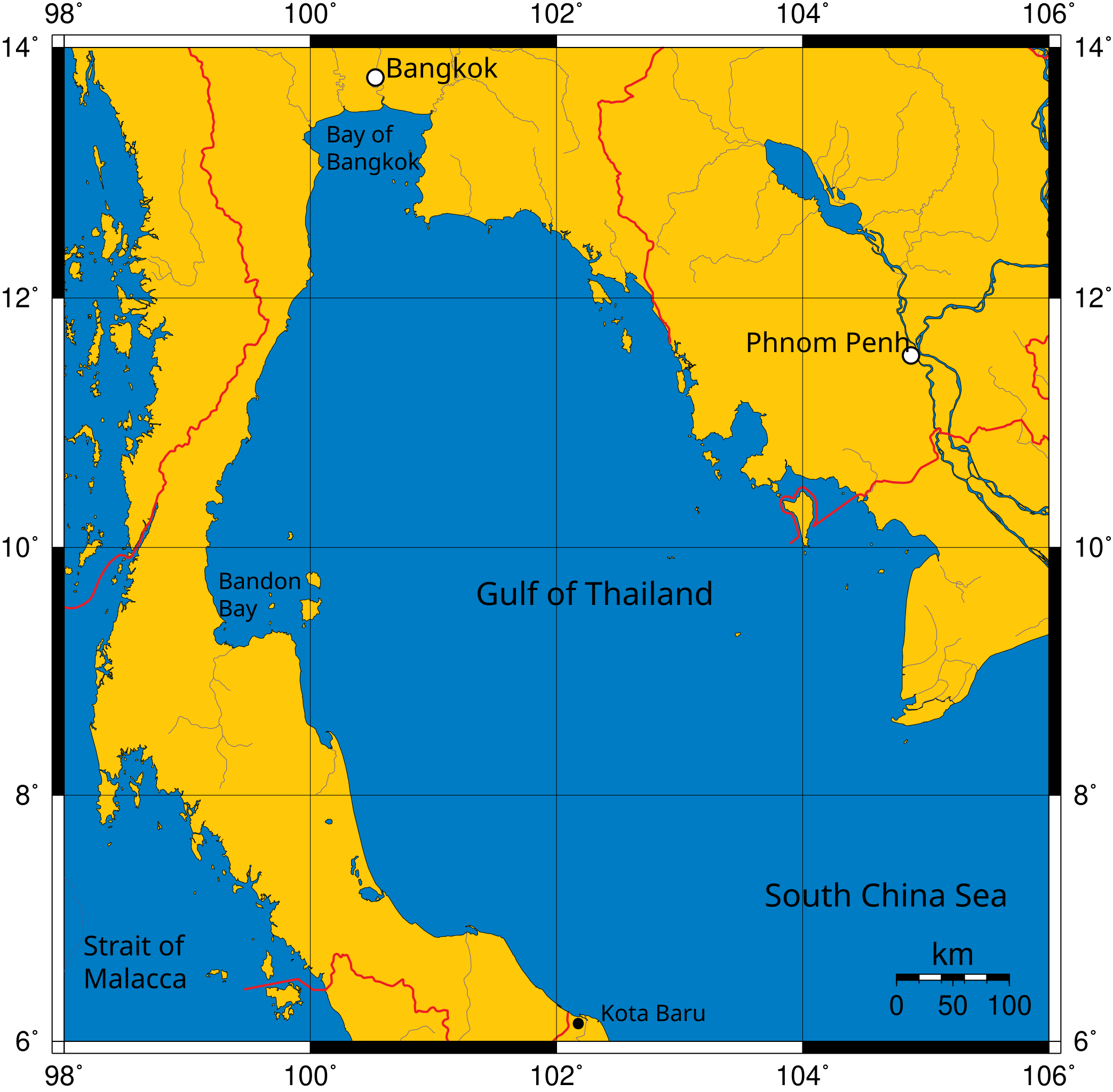
Mercator projection of Gulf of Thailand.
Public Domain map created by Online Map Creation:
http://www.aquarius.geomar.de/omc/omc_intro.html archive copy at the Wayback Machine
Modified by me (User:Feydey).
Other versions
-
 Italiano
 -
 Македонски
 -
 বাংলা
বাংলা


| This work has been released into the public domain by its author, User:Feydey. This applies worldwide. In some countries this may not be legally possible; if so: User:Feydey grants anyone the right to use this work for any purpose, without any conditions, unless such conditions are required by law.
|
derivative works
Derivative works of this file:
Kronoloġija tal-fajl
Agħfas fuq il-grupp data/ħin biex tara l-fajl biex tara kif jidher dak il-ħin.
| Data/Ħin | Minjatura | Qisien | Utent | Kumment | |
|---|---|---|---|---|---|
| kurrenti | 11:06, 16 Jannar 2020 | | 488 × 479 (387 KB) | Paul 012 | The label "Andaman Sea" was in the area officially defined as the Strait of Malacca. |
| 17:53, 27 Ġunju 2007 |  | 488 × 479 (387 KB) | Feydey | Mercator projection of Gulf of Thailand. Public Domain map created by Online Map Creation: http://www.aquarius.geomar.de/omc/omc_intro.html Modified by me (User:Feydey). {{PD}} Category:Maps of seas |
Użu tal-fajl
Il-Paġna segwenti twassal għal din l-istampa:
L-użu globali tal-fajl
Il-wikis segwenti jużaw dan il-fajl:
- Użu fuq af.wikipedia.org
- Użu fuq azb.wikipedia.org
- Użu fuq br.wikipedia.org
- Użu fuq ca.wikipedia.org
- Użu fuq ckb.wikipedia.org
- Użu fuq da.wikipedia.org
- Użu fuq de.wikinews.org
- Użu fuq el.wikipedia.org
- Użu fuq en.wikipedia.org
- Użu fuq fa.wikipedia.org
- Użu fuq fi.wikipedia.org
- Użu fuq fr.wikipedia.org
- Użu fuq hi.wikipedia.org
- Użu fuq hu.wikipedia.org
- Użu fuq ilo.wikipedia.org
- Użu fuq io.wikipedia.org
- Użu fuq ja.wikipedia.org
- Użu fuq ka.wikipedia.org
- Użu fuq km.wikipedia.org
- Użu fuq ko.wikipedia.org
- Użu fuq la.wikipedia.org
- Użu fuq lo.wikipedia.org
- Użu fuq min.wikipedia.org
- Użu fuq ml.wikipedia.org
- Użu fuq mr.wikipedia.org
- Użu fuq ms.wikipedia.org
- Użu fuq my.wikipedia.org
- Użu fuq nn.wikipedia.org
- Użu fuq pa.wikipedia.org
- Użu fuq pnb.wikipedia.org
- Użu fuq simple.wikipedia.org
- Użu fuq sr.wikipedia.org
- Użu fuq sv.wikipedia.org
- Użu fuq sw.wikipedia.org
- Użu fuq ta.wikipedia.org
- Użu fuq th.wikipedia.org
- Użu fuq tl.wikipedia.org
- Użu fuq tr.wikipedia.org
- Użu fuq uk.wikipedia.org
- Użu fuq ur.wikipedia.org
- Użu fuq vi.wikipedia.org
- Użu fuq war.wikipedia.org
- Użu fuq xmf.wikipedia.org
Ara l-użu globali ta' dan il-fajl.