Stampa:Guinea map 1725.jpg

Daqs tad-dehra proviżorja: 800 × 449 pixels. Riżoluzzjonijiet oħra: 320 × 179 pixels | 640 × 359 pixels | 997 × 559 pixels
Fajl oriġinali (997 × 559 pixel, dimensjoni: 280 KB, tip ta' MIME: image/jpeg)
| Dan huwa fajl mill-Wikimedia Commons. Il-deskrizzjoni fuq il-paġna ta' diskussjoni oriġinali tidher hawn taħt.
|
Taqsira
| Deskrizzjoni |
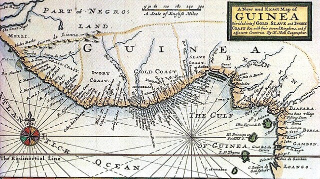
English: Historic map of the coast of West Africa, then called "Guinea", c. 1725 by Herman Moll (1654? – 22 September 1732), a London cartographer, engraver, and publisher.
Nederlands: Historische kaart van de kust van West-Afrika, destijds "Guinee" genoemd, ong. 1725, door Herman Moll. (1654? - 22 september 1732), een Londense cartograaf, graveur en uitgever.
Deutsch: Historische Karte der Küste Westafrikas, damals "Guinea" genannt, ca. 1725, von Herman Moll. (1654? - 22. September 1732), ein Londoner Kartograph, Kupferstecher und Verleger. |
| Sors | http://pirateshold.buccaneersoft.com/images/maps/guinea-map.jpg and other sources |
| Awtur | Herman Moll |
Liċenzja
|
This is a faithful photographic reproduction of a two-dimensional, public domain work of art. The work of art itself is in the public domain for the following reason:
The official position taken by the Wikimedia Foundation is that "faithful reproductions of two-dimensional public domain works of art are public domain".
This photographic reproduction is therefore also considered to be in the public domain in the United States. In other jurisdictions, re-use of this content may be restricted; see Reuse of PD-Art photographs for details. | ||||
Kronoloġija tal-fajl
Agħfas fuq il-grupp data/ħin biex tara l-fajl biex tara kif jidher dak il-ħin.
| Data/Ħin | Minjatura | Qisien | Utent | Kumment | |
|---|---|---|---|---|---|
| kurrenti | 14:10, 8 Lulju 2020 | | 997 × 559 (280 KB) | 0m9Ep | Brightness, color |
| 17:50, 4 Novembru 2007 |  | 997 × 559 (258 KB) | Ahanta | {{Information |Description=Historic map of the guineas coast |Source=http://pirateshold.buccaneersoft.com/images/maps/guinea-map.jpg and other sources |Date= |Author= |Permission= |other_versions= }} Category:Africa |
Użu tal-fajl
Il-Paġna segwenti twassal għal din l-istampa:
L-użu globali tal-fajl
Il-wikis segwenti jużaw dan il-fajl:
- Użu fuq als.wikipedia.org
- Użu fuq ca.wikipedia.org
- Użu fuq da.wikipedia.org
- Użu fuq de.wikipedia.org
- Użu fuq en.wikipedia.org
- Użu fuq eo.wikipedia.org
- Użu fuq es.wikipedia.org
- Użu fuq eu.wikipedia.org
- Użu fuq fi.wikipedia.org
- Użu fuq fr.wikipedia.org
- Użu fuq id.wikipedia.org
- Użu fuq it.wikipedia.org
- Użu fuq ja.wikipedia.org
- Użu fuq ko.wikipedia.org
- Użu fuq la.wikipedia.org
- Użu fuq lt.wikipedia.org
- Użu fuq nl.wikipedia.org
- Użu fuq no.wikipedia.org
- Użu fuq pt.wikipedia.org
- Użu fuq ru.wikipedia.org
- Użu fuq simple.wikipedia.org
- Użu fuq sv.wikipedia.org
Ara l-użu globali ta' dan il-fajl.