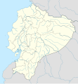
Stampa:Ecuador location map.svg

Size of this PNG preview of this SVG file: 556 × 599 pixels. Riżoluzzjonijiet oħra: 223 × 240 pixels | 445 × 480 pixels | 713 × 768 pixels | 950 × 1,024 pixels | 1,901 × 2,048 pixels | 1,535 × 1,654 pixels
Fajl oriġinali (Fajl fil-format SVG, dimensjoni nominali 1,535 × 1,654 pixel, dimensjoni tal-fajl: 1.03 MB)
Kronoloġija tal-fajl
Agħfas fuq il-grupp data/ħin biex tara l-fajl biex tara kif jidher dak il-ħin.
| Data/Ħin | Minjatura | Qisien | Utent | Kumment | |
|---|---|---|---|---|---|
| kurrenti | 23:57, 2 Ġunju 2023 |  | 1,535 × 1,654 (1.03 MB) | Milenioscuro | code clean |
| 23:59, 18 April 2023 |  | 1,535 × 1,654 (1.91 MB) | David C. S. | Límites | |
| 23:55, 18 April 2023 |  | 1,535 × 1,654 (1.91 MB) | David C. S. | Límites y ríos | |
| 03:30, 3 April 2023 |  | 1,535 × 1,654 (1.86 MB) | David C. S. | Límites | |
| 23:40, 30 Marzu 2023 |  | 1,535 × 1,654 (1.79 MB) | David C. S. | Límites y ríos | |
| 23:20, 24 Marzu 2023 |  | 1,535 × 1,654 (1.5 MB) | David C. S. | Límites y ríos | |
| 16:28, 13 Frar 2023 |  | 1,535 × 1,654 (1.37 MB) | David C. S. | Límites y ríos | |
| 21:03, 1 Mejju 2018 |  | 1,535 × 1,654 (246 KB) | Janitoalevic | Added Payana island to Ecuador color. | |
| 18:48, 20 Ġunju 2012 |  | 1,535 × 1,654 (242 KB) | NordNordWest | upd | |
| 16:28, 14 Ġunju 2012 |  | 1,535 × 1,654 (231 KB) | NordNordWest | Reverted to version as of 10:28, 14 June 2012. See your talk page. Please do not change this map again. |
Użu tal-fajl
L-użu globali tal-fajl
Il-wikis segwenti jużaw dan il-fajl:
- Użu fuq af.wikipedia.org
- Użu fuq an.wikipedia.org
- Użu fuq ar.wikipedia.org
- Użu fuq ast.wikipedia.org
- Quitu
- Volcán Chimborazo
- Palaciu Llexislativu d'Ecuador
- Volcán Cotopaxi
- Módulu:Mapa de llocalización/datos/Ecuador
- Campeonatu Suramericanu 1947
- Copa América 1993
- Universidá Central del Ecuador
- Aeropuertu Chachoan - Ambato
- Aeropuertu Francisco de Orellana
- Aeropuertu General Manuel Serrano - Machala
- Aeropuertu Internacional Mariscal Sucre
- Aeropuertu José María Velasco Ibarra - Macará
- Aeropuertu Jumandy
- Aeropuertu Mayor Galo de la Torre
- Aeropuertu Río Amazonas
- Aeropuertu de Lago Agrio
- Antiguu Aeropuertu Internacional Mariscal Sucre
- Puertu de Manta
- Módulu:Mapa de llocalización/datos/Ecuador/usu
- Golfu de Guayaquil
- Użu fuq az.wikipedia.org
- Użu fuq ban.wikipedia.org
- Użu fuq be-tarask.wikipedia.org
- Użu fuq be.wikipedia.org
Ara l-użu globali ta' dan il-fajl.

