Stampa:CEM-15-Asia-Mercator-1595-Russia-2533.jpg
Daqs tad-dehra proviżorja: 800 × 600 pixels. Riżoluzzjonijiet oħra: 320 × 240 pixels | 640 × 480 pixels | 1,024 × 768 pixels | 1,280 × 960 pixels | 2,560 × 1,920 pixels
Fajl oriġinali (2,560 × 1,920 pixel, dimensjoni: 2.07 MB, tip ta' MIME: image/jpeg)
| Dan huwa fajl mill-Wikimedia Commons. Il-deskrizzjoni fuq il-paġna ta' diskussjoni oriġinali tidher hawn taħt.
|
| Deskrizzjoni |
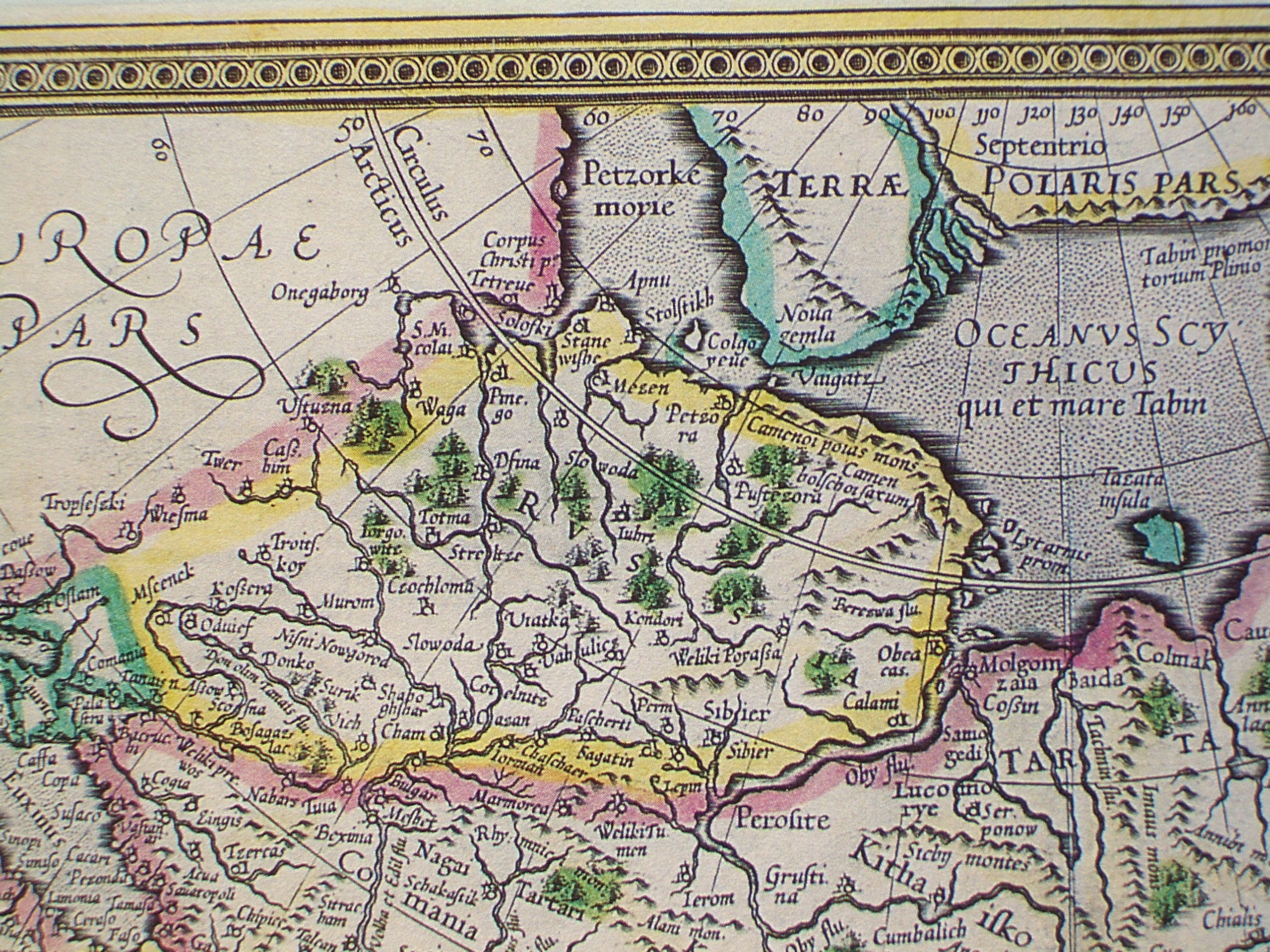
Latina: Asia ex magna Orbis terrae descriptione Gerardi Mercatoris desumpta, studio & industria G.M. Iunioris
English: Asia from the great World [atlas] described by Gerhard Mercator, selected with zeal and diligence by Gerhard Mercator the Younger
English: Fragment - Russia |
||||||||||||||||||||||||||
| Data | Originally published 1595; this is a 1628 reprint. | ||||||||||||||||||||||||||
| Sors |
English: An antique map from the Special Collection "China in Maps" of the Hong Kong University of Science and Technology Library, reproduced by the HKUST Library in the book "China in European Maps", Hong Kong, 2003. ISBN 962-86403-9-9.
Русский: Старинная карта из специальной коллекции Библиотеки Гонконгского научно-технического университета. Опубликована этой библиотекой в книге "China in European Maps" (Китай на европейских картах), Гонконг, 2003. ISBN 962-86403-9-9, тиражом 1000 экз. См. также каталог выставки, Special Collection "China in Maps".
Plate 15 |
||||||||||||||||||||||||||
| Awtur |
|
||||||||||||||||||||||||||
| Permess (Użu mill-ġdid tal-fajl) |
Author died more than 70 years ago - public domain | ||||||||||||||||||||||||||
| Verżjonijiet oħra |
Entire map:  |
||||||||||||||||||||||||||


|
This work is in the public domain in its country of origin and other countries and areas where the copyright term is the author's life plus 100 years or fewer. | |
| This file has been identified as being free of known restrictions under copyright law, including all related and neighboring rights. | |
Kronoloġija tal-fajl
Agħfas fuq il-grupp data/ħin biex tara l-fajl biex tara kif jidher dak il-ħin.
| Data/Ħin | Minjatura | Qisien | Utent | Kumment | |
|---|---|---|---|---|---|
| kurrenti | 12:03, 21 Marzu 2009 | | 2,560 × 1,920 (2.07 MB) | Vmenkov | {{Information |Description={{la|Asia ex magna Orbis terrae descriptione Gerardi Mercatoris desumpta, studio & industria G.M. Iunioris}} {{en|Asia from the great World [atlas] described by Gerhard Mercator, selected with zeal and diligence by Gerhard Merca |
Użu tal-fajl
Il-Paġna segwenti twassal għal din l-istampa:
L-użu globali tal-fajl
Il-wikis segwenti jużaw dan il-fajl:
- Użu fuq arz.wikipedia.org
- Użu fuq azb.wikipedia.org
- Użu fuq be.wikipedia.org
- Użu fuq bg.wikipedia.org
- Użu fuq cs.wikipedia.org
- Użu fuq da.wikipedia.org
- Użu fuq de.wikipedia.org
- Użu fuq el.wikipedia.org
- Użu fuq en.wikipedia.org
- Użu fuq es.wikipedia.org
- Użu fuq fi.wikipedia.org
- Użu fuq fr.wikipedia.org
- Użu fuq it.wikipedia.org
- Użu fuq kk.wikipedia.org
- Użu fuq ko.wikipedia.org
- Użu fuq kv.wikipedia.org
- Użu fuq la.wikipedia.org
- Użu fuq lv.wikipedia.org
- Użu fuq pl.wikipedia.org
- Użu fuq pnb.wikipedia.org
- Użu fuq ro.wikipedia.org
- Użu fuq ru.wikipedia.org
- Użu fuq ru.wikiquote.org
- Użu fuq sl.wikipedia.org
- Użu fuq sv.wikipedia.org
- Użu fuq tr.wikipedia.org
- Użu fuq uk.wikipedia.org