Stampa:Arran satellite.jpg
Daqs tad-dehra proviżorja: 396 × 599 pixels. Riżoluzzjonijiet oħra: 158 × 240 pixels | 317 × 480 pixels | 752 × 1,138 pixels
Fajl oriġinali (752 × 1,138 pixel, dimensjoni: 144 KB, tip ta' MIME: image/jpeg)
| Dan huwa fajl mill-Wikimedia Commons. Il-deskrizzjoni fuq il-paġna ta' diskussjoni oriġinali tidher hawn taħt.
|
Taqsira
| Deskrizzjoni |
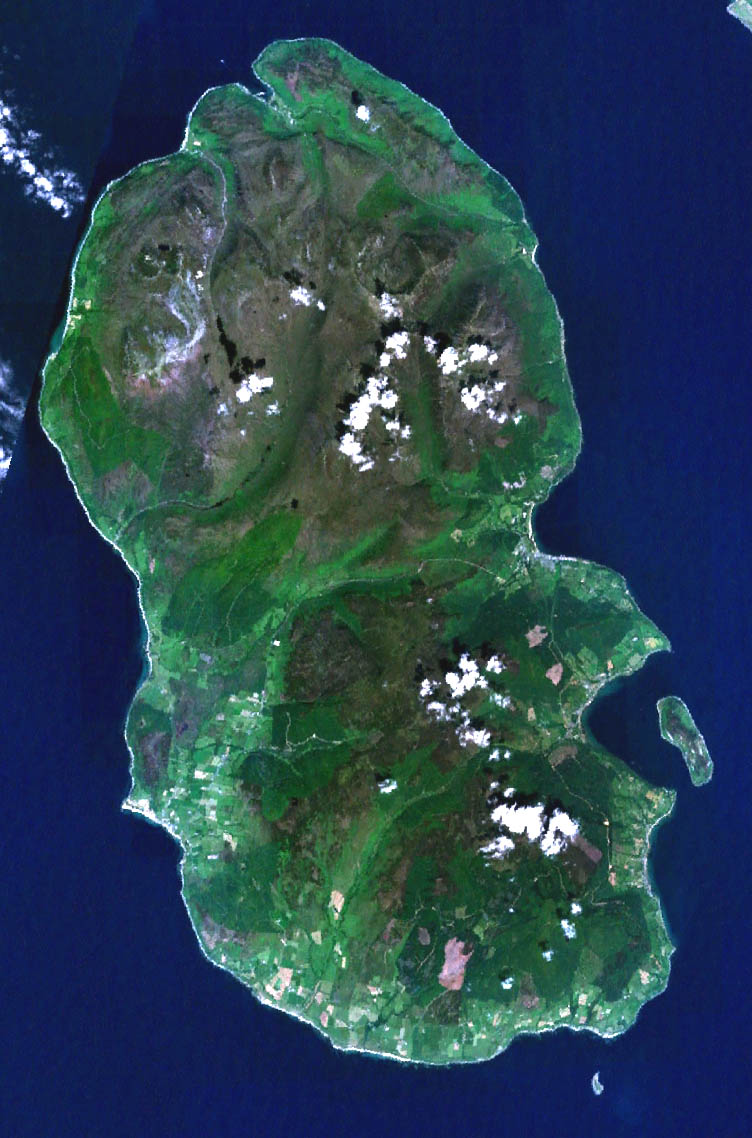
English: Landsat image of the Isle of Arran in Scotland. |
||
| Data | 4 Lulju 2005 (original upload date) | ||
| Sors |
NASA Landsat image. Made with World Wind. |
||
| Awtur | NASA | ||
| Verżjonijiet oħra |
|

Liċenzja
| This image is in the public domain because it is a screenshot from NASA’s globe software World Wind using a public domain layer, such as Blue Marble, MODIS, Landsat, SRTM, USGS or GLOBE.
|
 |
Kronoloġija tal-fajl
Agħfas fuq il-grupp data/ħin biex tara l-fajl biex tara kif jidher dak il-ħin.
| Data/Ħin | Minjatura | Qisien | Utent | Kumment | |
|---|---|---|---|---|---|
| kurrenti | 05:45, 11 Mejju 2006 | | 752 × 1,138 (144 KB) | 汲平 | This came from en:Image:Arran satellite.jpg posted by en:User:Finlay McWalter on July 4, 2005 under PD-USGov-NASA. The original page says "NASA Landsat image of the Isle of Arran in Scotland. Made with World Wind." |
Użu tal-fajl
Il-Paġna segwenti twassal għal din l-istampa:
L-użu globali tal-fajl
Il-wikis segwenti jużaw dan il-fajl:
- Użu fuq ar.wikipedia.org
- Użu fuq az.wikipedia.org
- Użu fuq be.wikipedia.org
- Użu fuq br.wikipedia.org
- Użu fuq de.wikipedia.org
- Użu fuq el.wikipedia.org
- Użu fuq en.wikipedia.org
- Brodick
- Lamlash
- Arran distillery
- Blackwaterfoot
- Lochranza
- Whiting Bay
- Holy Island, Firth of Clyde
- Goat Fell
- Brodick Castle
- Pladda
- Lochranza Castle
- Catacol
- Caisteal Abhail
- Corrie, Arran
- Kilmory, Arran
- Tighvein
- Sliddery
- Shiskine
- Kildonan, Arran
- Pirnmill
- Sannox
- Cladach
- Beinn Tarsuinn (Corbett)
- Sleeping Warrior
- Lagg, Arran
- Cìr Mhòr
- Dippen, Arran
- Creag Ghlas Laggan
- Machrie
- Whitefarland
- List of places in North Ayrshire
- Isle of Arran
- The Arran Banner
- Template:Isle of Arran
- Eas a' Chrannaig
- Beinn Bharrain
- Użu fuq es.wikipedia.org
- Użu fuq fr.wikipedia.org
Ara l-użu globali ta' dan il-fajl.