Stampa:Aerial-GoletaArea.jpg
Daqs tad-dehra proviżorja: 800 × 323 pixels. Riżoluzzjonijiet oħra: 320 × 129 pixels | 1,024 × 413 pixels
Fajl oriġinali (1,024 × 413 pixel, dimensjoni: 109 KB, tip ta' MIME: image/jpeg)
| Dan huwa fajl mill-Wikimedia Commons. Il-deskrizzjoni fuq il-paġna ta' diskussjoni oriġinali tidher hawn taħt.
|
Taqsira
| Deskrizzjoni |
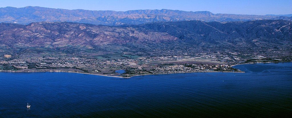
Aerial photo of the Goleta area, Santa Barbara County, California — from offshore.
|
| Data | 11am |
| Sors | Opra proprja |
| Awtur | John Wiley User:Jw4nvc - Santa Barbara, California |
| Permess (Użu mill-ġdid tal-fajl) |
*For full details on Permissions for this user's work, see: User:Jw4nvc/permission/details |
Liċenzja
Jiena, id-detentur tal-copyright ta' dan ix-xogħol, niddikjara li se nippubblikah taħt il-liċenzja segwenti:
Dan il-fajl huwa liċenzjat taħt it-termini tal-liċenzja Creative Commons Attribuzzjoni 3.0 Unported
- Inti ħieles:
- li taqsam – li tikkopja, tiddistribwixxi u tittrażmetti din l-opra
- li timmodifika – li tadatta l-biċċa xogħol
- Taħt il-kundizzjonijiet segwenti:
- attribuzzjoni – Għandek tattribwixxi x-xogħol bil-mod speċifikat mill-awtur jew minn min ta l-l-iċenzja (imma mhux b'xi mod li jissuġġerixxi ji jappoġjaw lilek jew l-użu tax-xogħol).
Kronoloġija tal-fajl
Agħfas fuq il-grupp data/ħin biex tara l-fajl biex tara kif jidher dak il-ħin.
| Data/Ħin | Minjatura | Qisien | Utent | Kumment | |
|---|---|---|---|---|---|
| kurrenti | 22:19, 28 Jannar 2009 | 1,024 × 413 (109 KB) | Jw4nvc | == Summary == {{Information |Description=Aerial photo of Goleta, California area from offshore |Source=self-made |Date=January 12, 2009 11am |Author= MyName (Jw4nvc (<span class="signature-talk">talk</span>)) |other_v |
Użu tal-fajl
Il-Paġna segwenti twassal għal din l-istampa:
L-użu globali tal-fajl
Il-wikis segwenti jużaw dan il-fajl:
- Użu fuq ar.wikipedia.org
- Użu fuq arz.wikipedia.org
- Użu fuq azb.wikipedia.org
- Użu fuq bg.wikipedia.org
- Użu fuq ceb.wikipedia.org
- Użu fuq ce.wikipedia.org
- Użu fuq de.wikivoyage.org
- Użu fuq en.wikipedia.org
- Użu fuq es.wikipedia.org
- Użu fuq eu.wikipedia.org
- Użu fuq fa.wikipedia.org
- Użu fuq fr.wikipedia.org
- Użu fuq ht.wikipedia.org
- Użu fuq hu.wikipedia.org
- Użu fuq it.wikipedia.org
- Użu fuq it.wikivoyage.org
- Użu fuq ja.wikipedia.org
- Użu fuq lld.wikipedia.org
- Użu fuq ml.wikipedia.org
- Użu fuq no.wikipedia.org
- Użu fuq pl.wikipedia.org
- Użu fuq pt.wikipedia.org
- Użu fuq sr.wikipedia.org
- Użu fuq sw.wikipedia.org
- Użu fuq tr.wikipedia.org
- Użu fuq tt.wikipedia.org
- Użu fuq uk.wikipedia.org
- Użu fuq ur.wikipedia.org
- Użu fuq vo.wikipedia.org
- Użu fuq www.wikidata.org
- Użu fuq zh-min-nan.wikipedia.org