Stampa:Provinces of Cameroon numbered.svg

Fajl oriġinali (Fajl fil-format SVG, dimensjoni nominali 586 × 769 pixel, dimensjoni tal-fajl: 1.22 MB)
| Dan huwa fajl mill-Wikimedia Commons. Il-deskrizzjoni fuq il-paġna ta' diskussjoni oriġinali tidher hawn taħt.
|
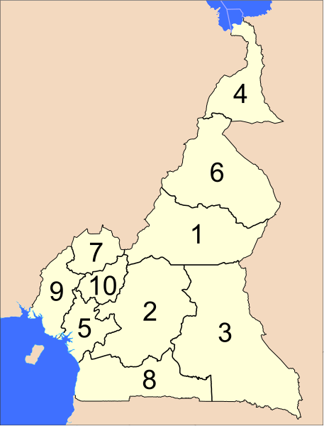
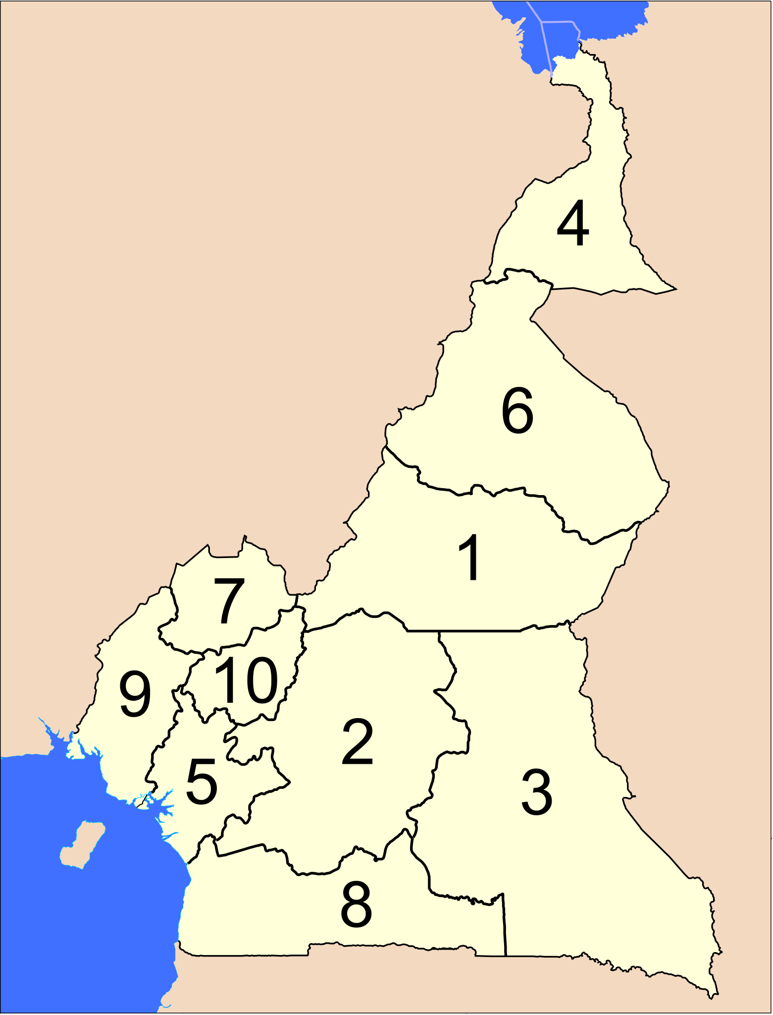
The provinces of Cameroon.
Modified from http://www.un.org/Depts/Cartographic/map/profile/cameroon.pdf
| This image is a map derived from a United Nations map.
Unless stated otherwise, UN maps are to be considered in the public domain. This applies worldwide. UN maps are, in principle, open source material and you can use them in your work or for making your own map. UN requests however that you delete the UN name, logo and reference number upon any modification to the map. Content of your map will be your responsibility. You can state in your publication, if you wish, something like: based on UN map … (map name, map number, revision number and date). See: Geospatial Information Section. And: Geospatial, location data for a better world. |
 |
Kronoloġija tal-fajl
Agħfas fuq il-grupp data/ħin biex tara l-fajl biex tara kif jidher dak il-ħin.
| Data/Ħin | Minjatura | Qisien | Utent | Kumment | |
|---|---|---|---|---|---|
| kurrenti | 04:39, 10 April 2007 | | 586 × 769 (1.22 MB) | Interiot~commonswiki | The provinces of Cameroon. Modified from http://www.un.org/Depts/Cartographic/map/profile/cameroon.pdf {{UN map}} Category:SVG maps of Africa |
Użu tal-fajl
Il-Paġna segwenti twassal għal din l-istampa:
L-użu globali tal-fajl
Il-wikis segwenti jużaw dan il-fajl:
- Użu fuq ab.wikipedia.org
- Użu fuq ar.wikipedia.org
- Użu fuq bcl.wikipedia.org
- Użu fuq be-tarask.wikipedia.org
- Użu fuq be.wikipedia.org
- Użu fuq bg.wikipedia.org
- Użu fuq ca.wikipedia.org
- Użu fuq cs.wikipedia.org
- Użu fuq de.wikipedia.org
- Użu fuq en.wikipedia.org
- Użu fuq es.wikipedia.org
- Użu fuq eu.wikipedia.org
- Użu fuq fa.wikipedia.org
- Użu fuq fi.wikipedia.org
- Użu fuq guw.wikipedia.org
- Użu fuq hr.wikipedia.org
- Użu fuq id.wikipedia.org
- Użu fuq ja.wikipedia.org
- Użu fuq ka.wikipedia.org
- Użu fuq ko.wikipedia.org
- Użu fuq li.wikipedia.org
- Użu fuq lt.wikipedia.org
- Użu fuq mk.wikipedia.org
- Użu fuq nl.wikipedia.org
- Użu fuq no.wikipedia.org
- Użu fuq pt.wikipedia.org
- Użu fuq ru.wikipedia.org
- Użu fuq sco.wikipedia.org
- Użu fuq simple.wikipedia.org
- Użu fuq si.wikipedia.org
- Użu fuq sr.wikipedia.org
- Użu fuq sv.wikipedia.org
- Użu fuq tr.wikipedia.org
- Użu fuq uk.wikipedia.org
- Użu fuq ur.wikipedia.org
- Użu fuq zh-min-nan.wikipedia.org
- Użu fuq zh.wikipedia.org