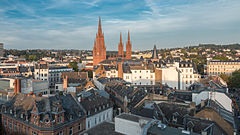
Stampa:MK29818 Wiesbaden.jpg

Daqs tad-dehra proviżorja: 800 × 450 pixels. Riżoluzzjonijiet oħra: 320 × 180 pixels | 640 × 360 pixels | 1,024 × 576 pixels | 1,280 × 720 pixels | 2,764 × 1,555 pixels
Fajl oriġinali (2,764 × 1,555 pixel, dimensjoni: 2.91 MB, tip ta' MIME: image/jpeg)
Kronoloġija tal-fajl
Agħfas fuq il-grupp data/ħin biex tara l-fajl biex tara kif jidher dak il-ħin.
| Data/Ħin | Minjatura | Qisien | Utent | Kumment | |
|---|---|---|---|---|---|
| kurrenti | 20:38, 3 Ottubru 2014 |  | 2,764 × 1,555 (2.91 MB) | Martin Kraft | Uploaded with LrMediaWiki 0.2.2 |
Użu tal-fajl
Il-Paġna segwenti twassal għal din l-istampa:
L-użu globali tal-fajl
Il-wikis segwenti jużaw dan il-fajl:
- Użu fuq ar.wikipedia.org
- Użu fuq arz.wikipedia.org
- Użu fuq ast.wikipedia.org
- Użu fuq az.wikipedia.org
- Użu fuq bat-smg.wikipedia.org
- Użu fuq ba.wikipedia.org
- Użu fuq be-tarask.wikipedia.org
- Użu fuq be.wikipedia.org
- Użu fuq ca.wikipedia.org
- Użu fuq ceb.wikipedia.org
- Użu fuq ce.wikipedia.org
- Użu fuq cy.wikipedia.org
- Użu fuq de.wikivoyage.org
- Użu fuq diq.wikipedia.org
- Użu fuq el.wikipedia.org
- Użu fuq en.wikivoyage.org
- Użu fuq es.wikipedia.org
- Użu fuq eu.wikipedia.org
- Użu fuq fr.wikivoyage.org
- Użu fuq ga.wikipedia.org
- Użu fuq gl.wikipedia.org
- Użu fuq ha.wikipedia.org
- Użu fuq he.wikivoyage.org
- Użu fuq hu.wikipedia.org
- Użu fuq hy.wikipedia.org
- Użu fuq hyw.wikipedia.org
- Użu fuq ia.wikipedia.org
- Użu fuq it.wikipedia.org
- Użu fuq it.wikivoyage.org
- Użu fuq ja.wikivoyage.org
- Użu fuq kk.wikipedia.org
- Użu fuq ku.wikipedia.org
- Użu fuq lmo.wikipedia.org
- Użu fuq nn.wikipedia.org
- Użu fuq os.wikipedia.org
- Użu fuq pl.wikipedia.org
- Użu fuq ru.wikinews.org
- Użu fuq sr.wikipedia.org
- Użu fuq tg.wikipedia.org
- Użu fuq tl.wikipedia.org
- Użu fuq tt.wikipedia.org
- Użu fuq uz.wikipedia.org
- Użu fuq vec.wikipedia.org
Ara l-użu globali ta' dan il-fajl.
