Stampa:SpainDueroBasin.png

Daqs tad-dehra proviżorja: 800 × 572 pixels. Riżoluzzjonijiet oħra: 320 × 229 pixels | 640 × 457 pixels | 1,024 × 732 pixels | 1,280 × 915 pixels | 1,748 × 1,249 pixels
Fajl oriġinali (1,748 × 1,249 pixel, dimensjoni: 2.55 MB, tip ta' MIME: image/png)
| Dan huwa fajl mill-Wikimedia Commons. Il-deskrizzjoni fuq il-paġna ta' diskussjoni oriġinali tidher hawn taħt.
|
Taqsira
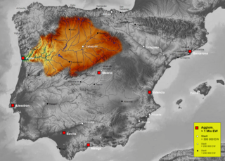
| Deskrizzjoni | Map of Duero river basin in Spain, Karte des hydrogeografischen Beckens des Duero |
| Data | |
| Sors | Own work, based on an image of http://www.maps-for-free.com/ (Creative Commons Attribution Share Alike 3.0) |
| Awtur | Port(u*o)s |
| Permess (Użu mill-ġdid tal-fajl) |
Creative Commons Attribution Share Alike 3.0 |
Liċenzja
Dan il-fajl huwa liċenzjat taħt it-termini tal-liċenzja Creative Commons Attribuzzjoni-Aqsam bl-istess mod 3.0 Unported
- Inti ħieles:
- li taqsam – li tikkopja, tiddistribwixxi u tittrażmetti din l-opra
- li timmodifika – li tadatta l-biċċa xogħol
- Taħt il-kundizzjonijiet segwenti:
- attribuzzjoni – Għandek tattribwixxi x-xogħol bil-mod speċifikat mill-awtur jew minn min ta l-l-iċenzja (imma mhux b'xi mod li jissuġġerixxi ji jappoġjaw lilek jew l-użu tax-xogħol).
- Ixxerja bl-istess mod – Jekk tbiddel, tittrasforma jew tibni fuq dan il-materjal, inti għandek bżonn taqsam il-kontribuzzjonijiet tiegħek taħt l-istess liċenzja jew waħda li taqbel ma' dik oriġinali.
Kronoloġija tal-fajl
Agħfas fuq il-grupp data/ħin biex tara l-fajl biex tara kif jidher dak il-ħin.
| Data/Ħin | Minjatura | Qisien | Utent | Kumment | |
|---|---|---|---|---|---|
| kurrenti | 16:41, 7 Ottubru 2021 | | 1,748 × 1,249 (2.55 MB) | Lojwe | Santiago mal posicionada |
| 01:51, 5 Frar 2019 |  | 1,748 × 1,249 (2.11 MB) | TouchName | recorte de marco | |
| 02:07, 30 Ottubru 2007 |  | 1,808 × 1,307 (2.57 MB) | Port(u*o)s | == Summary == {{Information |Description=Map of Duero river basin in Spain, Karte des hydrogeografischen Beckens des Duero |Source= Own work, based on an image of http://www.maps-for-free.com/ (Creative Commons Attribution Share Alike 3.0) |Date=October 2 |
Użu tal-fajl
Il-Paġna segwenti twassal għal din l-istampa:
L-użu globali tal-fajl
Il-wikis segwenti jużaw dan il-fajl:
- Użu fuq af.wikipedia.org
- Użu fuq ast.wikipedia.org
- Użu fuq ca.wikipedia.org
- Użu fuq cs.wikipedia.org
- Użu fuq cv.wikipedia.org
- Użu fuq de.wikipedia.org
- Użu fuq el.wikipedia.org
- Użu fuq eo.wikipedia.org
- Użu fuq es.wikipedia.org
- Duero
- Río Carrión
- Pisuerga
- Eresma
- Adaja
- Río Arlanza
- Río Aliste
- Río Tera
- Río Zapardiel
- Río Guareña
- Río Huebra
- Río Jerga
- Úrbel
- Voltoya
- Río Duratón
- Río Margañán
- Anexo:Ríos de España
- Usuario discusión:NACLE
- Río Malo
- Cuenca hidrográfica del Duero
- Río Valdeginate
- Río Almar
- Río Grande (afluente del Carrión)
- Río Arevalillo
- Plantilla:Ficha de cuerpo de agua
- Plantilla:Ficha de cuerpo de agua/doc
- Río Negro (afluente del Omaña)
- Río Navajos
- Río Valdesamario
- Río Castro (afluente del Tera)
- Río Manzanas
- Río Tuela
- Río Gamoneda
- Río Truchas
- Río Cueza
Ara l-użu globali ta' dan il-fajl.