Stampa:Map of Cyrenaica.png

Daqs tad-dehra proviżorja: 800 × 543 pixels. Riżoluzzjonijiet oħra: 320 × 217 pixels | 640 × 434 pixels | 918 × 623 pixels
Fajl oriġinali (918 × 623 pixel, dimensjoni: 92 KB, tip ta' MIME: image/png)
| Dan huwa fajl mill-Wikimedia Commons. Il-deskrizzjoni fuq il-paġna ta' diskussjoni oriġinali tidher hawn taħt.
|
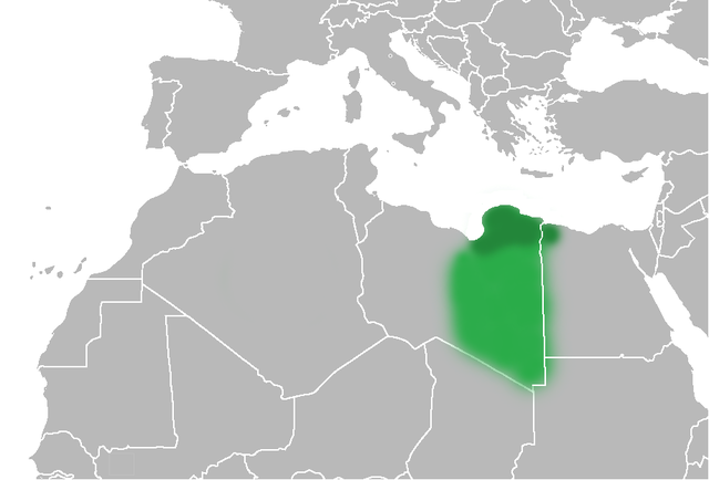
| Deskrizzjoni | The Ottoman Turks conquered the country in the mid-16th century, and the three States or "Wilayat" of Tripolitania, Cyrenaica and Fezzan (which make up Libya) remained part of their empire with the exception of the virtual autonomy of the Karamanlis. The Karamanlis ruled from 1711 until 1835 mainly in Tripolitania, but had influence in Cyrenaica and Fezzan as well by the mid 18th century. |
| Data | (UTC) |
| Sors | |
| Awtur |
|
| Verżjonijiet oħra | File:Map of Cyrenaica.svg |
.png)
| This is a retouched picture, which means that it has been digitally altered from its original version. Modifications: changes of area Cyrenaica. The original can be viewed here: Ottoman Provinces Of Present day Libyapng.png:
|
| I, the copyright holder of this work, release this work into the public domain. This applies worldwide. In some countries this may not be legally possible; if so: I grant anyone the right to use this work for any purpose, without any conditions, unless such conditions are required by law. |
Original upload log
This image is a derivative work of the following images:
- File:United_States_of_North_Africa_Locator.png licensed with PD-self
- 2010-03-26T13:53:08Z Roxanna 1160x1056 (29795 Bytes) {{Information |Description={{en|1="United States of North Africa" (proposal by President [[en:Habib Bourguiba]] for Tunisia, Algeria and Libya 1973) and "Arab Islamic Republic" (proposal by [[en:Muammar al-Gaddafi]] for a uni
- File:Ottoman_Provinces_Of_Present_day_Libyapng.png licensed with PD-self
Uploaded with derivativeFX
Kronoloġija tal-fajl
Agħfas fuq il-grupp data/ħin biex tara l-fajl biex tara kif jidher dak il-ħin.
| Data/Ħin | Minjatura | Qisien | Utent | Kumment | |
|---|---|---|---|---|---|
| kurrenti | 20:51, 1 Lulju 2010 | | 918 × 623 (92 KB) | Felitsata | change of border |
| 20:33, 1 Lulju 2010 |  | 918 × 623 (93 KB) | Felitsata | {{Information |Description={{en|1="United States of North Africa" (proposal by President [http://en.wikipedia.org/wiki/Habib_Bourguiba Habib Bourguiba] for Tunisia, Algeria and Libya 1973) and "Arab Islamic Republic" (proposal by [http://en.wikipedia.org/ |
Użu tal-fajl
L-ebda paġna fuq il-Wikipedija Maltija torbot lejn dan il-fajl.
L-użu globali tal-fajl
Il-wikis segwenti jużaw dan il-fajl:
- Użu fuq bg.wikipedia.org
- Użu fuq bn.wikipedia.org
- Użu fuq en.wikipedia.org
- Użu fuq es.wikipedia.org
- Użu fuq fa.wikipedia.org
- Użu fuq fi.wikipedia.org
- Użu fuq he.wikipedia.org
- Użu fuq hr.wikipedia.org
- Użu fuq hy.wikipedia.org
- Użu fuq inh.wikipedia.org
- Użu fuq it.wikipedia.org
- Użu fuq ja.wikipedia.org
- Użu fuq ko.wikipedia.org
- Użu fuq la.wiktionary.org
- Użu fuq nn.wikipedia.org
- Użu fuq pl.wiktionary.org
- Użu fuq ro.wikipedia.org
- Użu fuq ru.wikipedia.org
- Użu fuq sh.wikipedia.org
- Użu fuq sl.wikipedia.org
- Użu fuq sr.wikipedia.org
- Użu fuq th.wikipedia.org
- Użu fuq tr.wikipedia.org
- Użu fuq uk.wikipedia.org