Stampa:Java-Map.jpg
Fajl oriġinali (3,000 × 2,088 pixel, dimensjoni: 1.12 MB, tip ta' MIME: image/jpeg)
| Dan huwa fajl mill-Wikimedia Commons. Il-deskrizzjoni fuq il-paġna ta' diskussjoni oriġinali tidher hawn taħt.
|
Taqsira
| Deskrizzjoni |
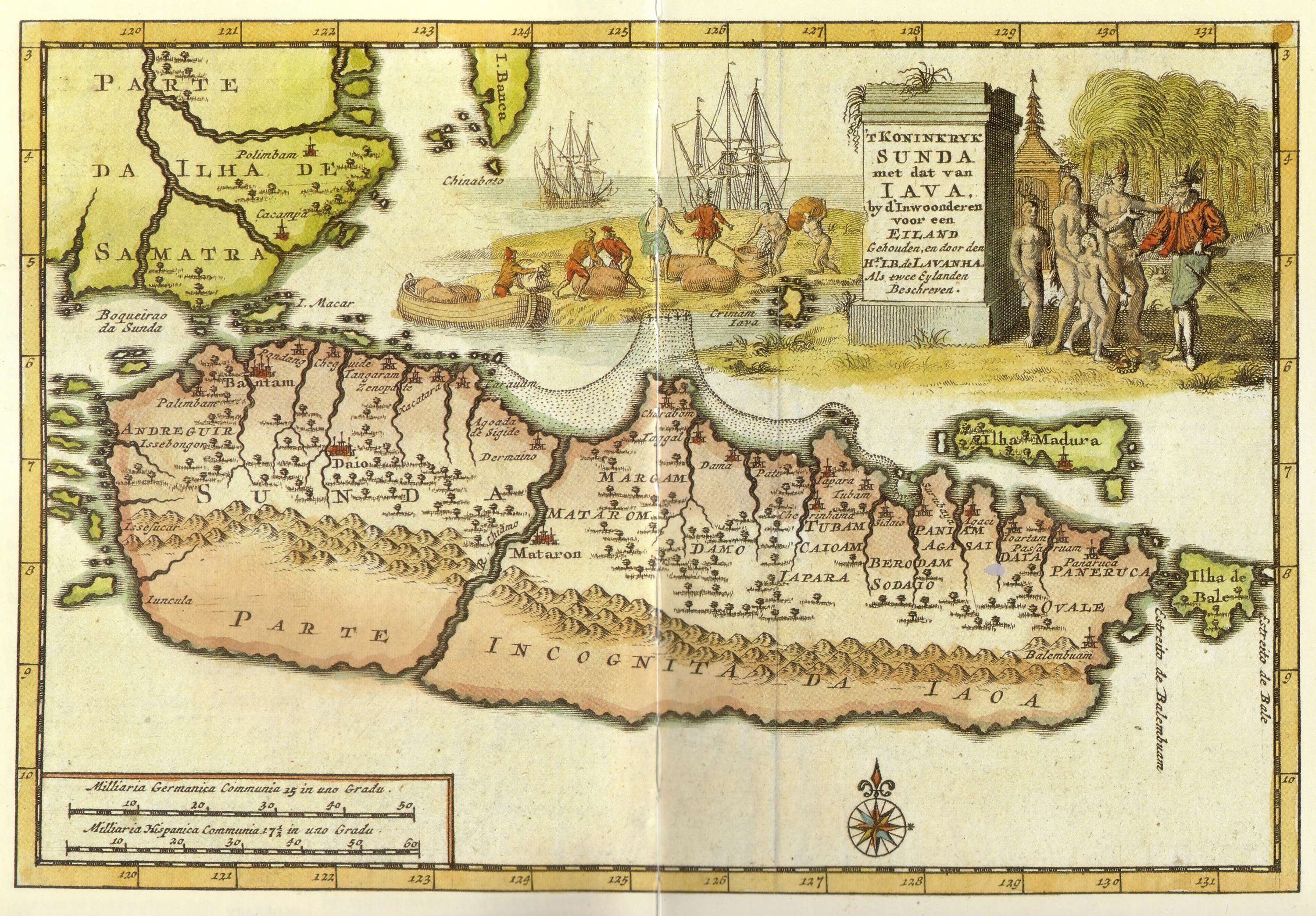
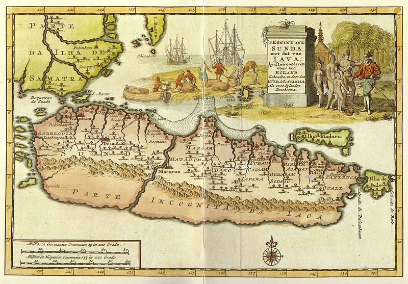
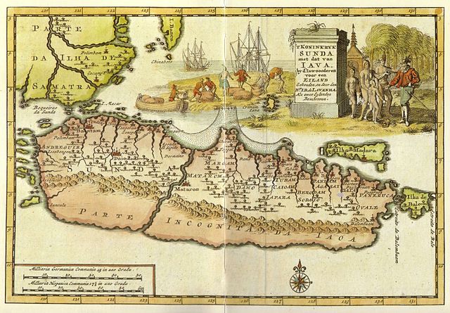
Kingdom of Sunda and Java as two islands. The toponym includes: |
| Data | early 18 century |
| Sors | from "Java" - Periplus Adventure Guide. Periplus Editions 1997. ISBN 962-593-244-5 |
| Awtur |
Pieter van der Aa (1659-1733) Hr. L. B. de Lavanha |
| Verżjonijiet oħra |
|

| Camera location | | View this and other nearby images on: OpenStreetMap |
|---|
Liċenzja
|
This work is in the public domain in its country of origin and other countries and areas where the copyright term is the author's life plus 70 years or fewer.
| |
| This file has been identified as being free of known restrictions under copyright law, including all related and neighboring rights. | |
Kronoloġija tal-fajl
Agħfas fuq il-grupp data/ħin biex tara l-fajl biex tara kif jidher dak il-ħin.
| Data/Ħin | Minjatura | Qisien | Utent | Kumment | |
|---|---|---|---|---|---|
| kurrenti | 12:12, 20 Jannar 2008 | | 3,000 × 2,088 (1.12 MB) | Merbabu~commonswiki | {{Information |Description=Early 18th century Dutch map. |Source= |Date=early 18th century |Author= |Permission= |other_versions= }} |
Użu tal-fajl
Il-Paġna segwenti twassal għal din l-istampa:
L-użu globali tal-fajl
Il-wikis segwenti jużaw dan il-fajl:
- Użu fuq ar.wikipedia.org
- Użu fuq ca.wikipedia.org
- Użu fuq en.wikipedia.org
- Użu fuq fr.wikipedia.org
- Użu fuq hr.wikipedia.org
- Użu fuq it.wikipedia.org
- Użu fuq ja.wikipedia.org
- Użu fuq mk.wikipedia.org
- Użu fuq nl.wikipedia.org
- Użu fuq pl.wikipedia.org
- Użu fuq pnb.wikipedia.org
- Użu fuq ru.wikipedia.org
- Użu fuq ur.wikipedia.org
- Użu fuq zh.wikipedia.org