Stampa:Hungary 1956-1990.svg

Size of this PNG preview of this SVG file: 450 × 456 pixels. Riżoluzzjonijiet oħra: 237 × 240 pixels | 474 × 480 pixels | 758 × 768 pixels | 1,011 × 1,024 pixels | 2,021 × 2,048 pixels
Fajl oriġinali (Fajl fil-format SVG, dimensjoni nominali 450 × 456 pixel, dimensjoni tal-fajl: 475 KB)
| Dan huwa fajl mill-Wikimedia Commons. Il-deskrizzjoni fuq il-paġna ta' diskussjoni oriġinali tidher hawn taħt.
|
Taqsira


.svg)
.svg)
.svg)
.svg)
.svg)


.svg)
.svg)
.svg)


.png)
.png)


.svg)


.svg)

.svg)


.svg)
.svg)
.svg)
.svg)


.svg)
.png)


.svg)


.svg)
.svg)


.svg)


.svg)


.svg)
.svg)
.svg)
.svg)
.svg)
.svg)
.svg)
_cropped.svg)
.svg)
.svg)
.svg)
.svg)
.svg)
.svg)
.svg)
.svg)
.svg)
.svg)
.svg)
.svg)
.svg)
.svg)
.svg)
.svg)
.svg)
.svg)
.svg)
.svg)
.svg)
.svg)
.svg)
.svg)
.svg)
.svg)
.svg)
.svg)
.svg)
.svg)
.svg)
.svg)
.svg)
.svg)
.svg)
.svg)
.svg)
.svg)
.svg)
.svg)
.svg)
.svg)
.svg)
.svg)
.svg)
| This is a retouched picture, which means that it has been digitally altered from its original version. The original can be viewed here: Blank map of Europe 1956-1990.svg:
|
Liċenzja
Jiena, id-detentur tal-copyright ta' dan ix-xogħol, niddikjara li se nippubblikah taħt il-liċenzja segwenti:
Dan il-fajl huwa liċenzjat taħt it-termini tal-liċenzja Creative Commons Attribuzzjoni-Aqsam bl-istess mod 3.0 Unported
- Inti ħieles:
- li taqsam – li tikkopja, tiddistribwixxi u tittrażmetti din l-opra
- li timmodifika – li tadatta l-biċċa xogħol
- Taħt il-kundizzjonijiet segwenti:
- attribuzzjoni – Għandek tattribwixxi x-xogħol bil-mod speċifikat mill-awtur jew minn min ta l-l-iċenzja (imma mhux b'xi mod li jissuġġerixxi ji jappoġjaw lilek jew l-użu tax-xogħol).
- Ixxerja bl-istess mod – Jekk tbiddel, tittrasforma jew tibni fuq dan il-materjal, inti għandek bżonn taqsam il-kontribuzzjonijiet tiegħek taħt l-istess liċenzja jew waħda li taqbel ma' dik oriġinali.
Original upload log
This image is a derivative work of the following images:
- File:Blank_map_of_Europe_1956-1990.svg licensed with Cc-by-sa-3.0
- 2011-10-30T04:43:42Z Alphathon 450x456 (485146 Bytes) == {{int:filedesc}} == {{Information |Description={{en|Blank map of Europe showing national borders as they stood from 1956-1990.}} |Source=*[[:File:Blank_map_of_Europe.svg|]] |Date=2011-10-30 04:42 (UTC) |Author=*[[:File:Bla
Kronoloġija tal-fajl
Agħfas fuq il-grupp data/ħin biex tara l-fajl biex tara kif jidher dak il-ħin.
| Data/Ħin | Minjatura | Qisien | Utent | Kumment | |
|---|---|---|---|---|---|
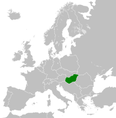
| kurrenti | 00:55, 26 Novembru 2011 | | 450 × 456 (475 KB) | StalwartUK | == {{int:filedesc}} == {{Information |Description={{en|Map of People's Republic of Hungary as it was from 1949-1989. Surrounding countries accurate from 1956-1990.}} |Source=*[[:File:Blank_map_of_Europe_1956-1990.svg|B |
Użu tal-fajl
Il-Paġna segwenti twassal għal din l-istampa:
L-użu globali tal-fajl
Il-wikis segwenti jużaw dan il-fajl:
- Użu fuq ar.wikipedia.org
- Użu fuq az.wikipedia.org
- Użu fuq be-tarask.wikipedia.org
- Użu fuq be.wikipedia.org
- Użu fuq bg.wikipedia.org
- Użu fuq br.wikipedia.org
- Użu fuq ca.wikipedia.org
- Użu fuq cs.wikipedia.org
- Użu fuq de.wikipedia.org
- Użu fuq el.wikipedia.org
- Użu fuq en.wikipedia.org
- Użu fuq eo.wikipedia.org
- Użu fuq es.wikipedia.org
- Użu fuq et.wikipedia.org
- Użu fuq fa.wikipedia.org
- Użu fuq fi.wikipedia.org
- Użu fuq fr.wikipedia.org
- Użu fuq gl.wikipedia.org
- Użu fuq he.wikipedia.org
- Użu fuq hr.wikipedia.org
- Użu fuq hu.wikipedia.org
- Użu fuq id.wikipedia.org
- Użu fuq it.wikipedia.org
- Użu fuq ja.wikipedia.org
- Użu fuq ko.wikipedia.org
- Użu fuq la.wikipedia.org
- Użu fuq lv.wikipedia.org
- Użu fuq mk.wikipedia.org
- Użu fuq ms.wikipedia.org
- Użu fuq nl.wikipedia.org
- Użu fuq pl.wikipedia.org
- Użu fuq pt.wikipedia.org
- Użu fuq ro.wikipedia.org
- Użu fuq rue.wikipedia.org
- Użu fuq ru.wikipedia.org
- Użu fuq sh.wikipedia.org
- Użu fuq simple.wikipedia.org
- Użu fuq sk.wikipedia.org
- Użu fuq sr.wikipedia.org
- Użu fuq sv.wikipedia.org
- Użu fuq th.wikipedia.org
- Użu fuq tl.wikipedia.org
- Użu fuq tr.wikipedia.org
- Użu fuq uk.wikipedia.org
Ara l-użu globali ta' dan il-fajl.