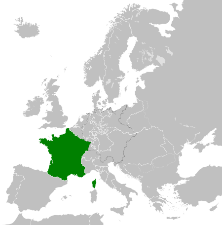
Stampa:French Kingdom within Europe 1839.svg

Size of this PNG preview of this SVG file: 450 × 456 pixels. Riżoluzzjonijiet oħra: 237 × 240 pixels | 474 × 480 pixels | 758 × 768 pixels | 1,011 × 1,024 pixels | 2,021 × 2,048 pixels
Fajl oriġinali (Fajl fil-format SVG, dimensjoni nominali 450 × 456 pixel, dimensjoni tal-fajl: 806 KB)
| Dan huwa fajl mill-Wikimedia Commons. Il-deskrizzjoni fuq il-paġna ta' diskussjoni oriġinali tidher hawn taħt.
|
Taqsira


.svg)
.svg)
.svg)
.svg)
.svg)


.svg)
.svg)
.svg)


.png)
.png)


.svg)


.svg)

.svg)


.svg)
.svg)
.svg)
.svg)


.svg)
.png)


.svg)


.svg)
.svg)


.svg)


.svg)


.svg)
.svg)
.svg)
.svg)
.svg)
.svg)
.svg)
_cropped.svg)
.svg)
.svg)
.svg)
.svg)
.svg)
.svg)
.svg)
.svg)
.svg)
.svg)
.svg)
.svg)
.svg)
.svg)
.svg)
.svg)
.svg)
.svg)
.svg)
.svg)
.svg)
.svg)
.svg)
.svg)
.svg)
.svg)
.svg)
.svg)
.svg)
.svg)
.svg)
.svg)
.svg)
.svg)
.svg)
.svg)
.svg)
.svg)
.svg)
.svg)
.svg)
.svg)
.svg)
.svg)
.svg)
Liċenzja
Jiena, id-detentur tal-copyright ta' dan ix-xogħol, niddikjara li se nippubblikah taħt il-liċenzja segwenti:
This file is licensed under the Creative Commons Attribution-Share Alike 4.0 International license.
- Inti ħieles:
- li taqsam – li tikkopja, tiddistribwixxi u tittrażmetti din l-opra
- li timmodifika – li tadatta l-biċċa xogħol
- Taħt il-kundizzjonijiet segwenti:
- attribuzzjoni – Għandek tattribwixxi x-xogħol bil-mod speċifikat mill-awtur jew minn min ta l-l-iċenzja (imma mhux b'xi mod li jissuġġerixxi ji jappoġjaw lilek jew l-użu tax-xogħol).
- Ixxerja bl-istess mod – Jekk tbiddel, tittrasforma jew tibni fuq dan il-materjal, inti għandek bżonn taqsam il-kontribuzzjonijiet tiegħek taħt l-istess liċenzja jew waħda li taqbel ma' dik oriġinali.
Kronoloġija tal-fajl
Agħfas fuq il-grupp data/ħin biex tara l-fajl biex tara kif jidher dak il-ħin.
| Data/Ħin | Minjatura | Qisien | Utent | Kumment | |
|---|---|---|---|---|---|
| kurrenti | 05:33, 31 Mejju 2016 | | 450 × 456 (806 KB) | Alphathon | Minor corrections (Tarasp and post-181 German Confederation border change) |
| 07:47, 14 Lulju 2015 |  | 450 × 456 (754 KB) | Elevatorrailfan | User created page with UploadWizard |
Użu tal-fajl
Il-Paġna segwenti twassal għal din l-istampa:
L-użu globali tal-fajl
Il-wikis segwenti jużaw dan il-fajl:
- Użu fuq azb.wikipedia.org
- Użu fuq az.wikipedia.org
- Użu fuq bn.wikipedia.org
- Użu fuq ca.wikipedia.org
- Użu fuq cs.wikipedia.org
- Użu fuq el.wikipedia.org
- Użu fuq en.wikipedia.org
- Użu fuq eo.wikipedia.org
- Użu fuq es.wikipedia.org
- Użu fuq et.wikipedia.org
- Użu fuq fa.wikipedia.org
- Użu fuq fi.wikipedia.org
- Użu fuq fr.wikipedia.org
- Użu fuq he.wikipedia.org
- Użu fuq hi.wikipedia.org
- Użu fuq hr.wikipedia.org
- Użu fuq id.wikipedia.org
- Użu fuq is.wikipedia.org
- Użu fuq it.wikipedia.org
- Użu fuq ja.wikipedia.org
- Użu fuq ka.wikipedia.org
- Użu fuq ko.wikipedia.org
- Użu fuq lv.wikipedia.org
- Użu fuq mk.wikipedia.org
- Użu fuq nl.wikipedia.org
- Użu fuq pnb.wikipedia.org
- Użu fuq pt.wikipedia.org
- Użu fuq ru.wikipedia.org
- Użu fuq simple.wikipedia.org
- Użu fuq sl.wikipedia.org
- Użu fuq sq.wikipedia.org
- Użu fuq sr.wikipedia.org
- Użu fuq th.wikipedia.org
Ara l-użu globali ta' dan il-fajl.