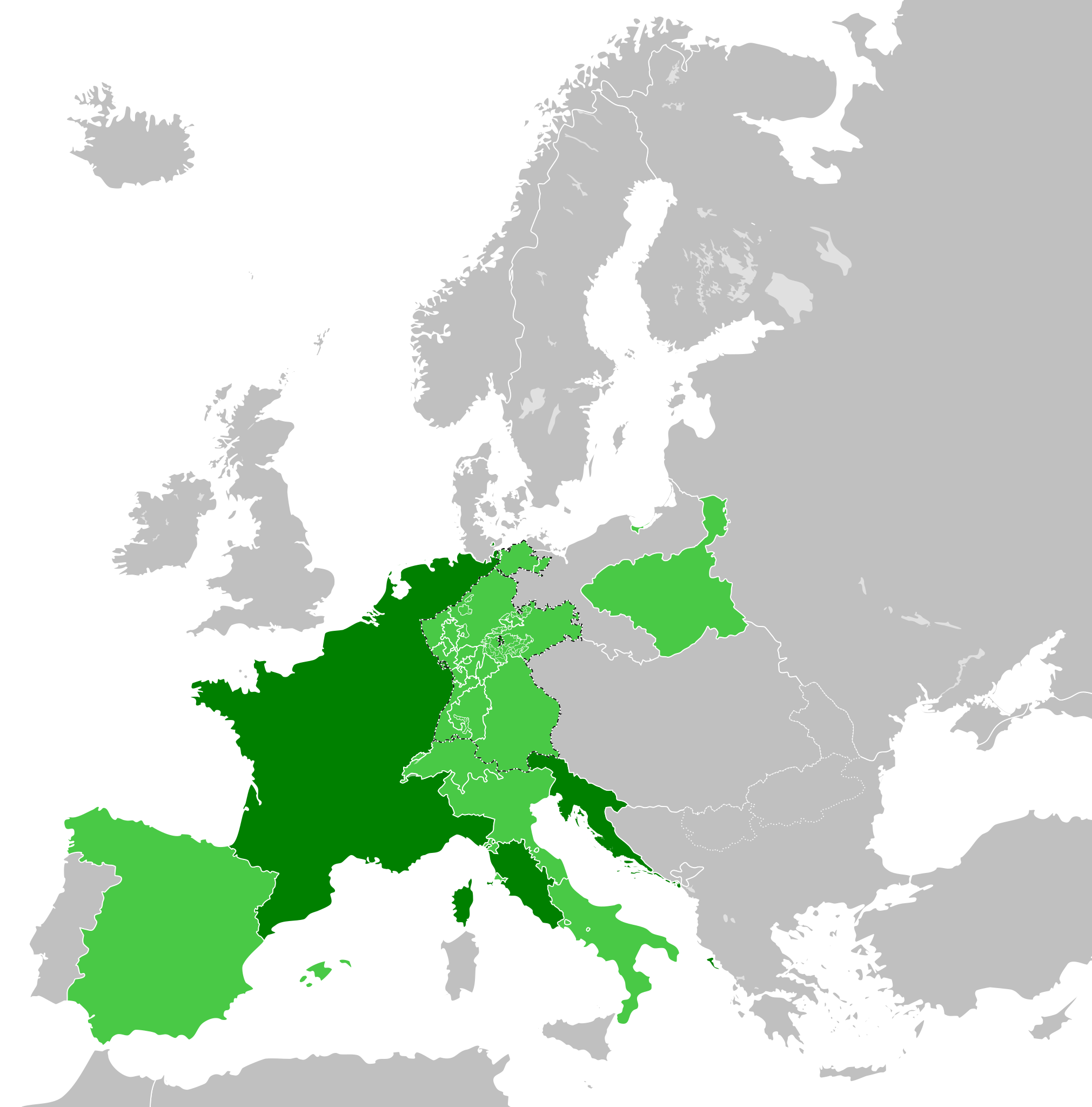
Stampa:French Empire (1812).svg

Size of this PNG preview of this SVG file: 450 × 456 pixels. Riżoluzzjonijiet oħra: 237 × 240 pixels | 474 × 480 pixels | 758 × 768 pixels | 1,011 × 1,024 pixels | 2,021 × 2,048 pixels
Fajl oriġinali (Fajl fil-format SVG, dimensjoni nominali 450 × 456 pixel, dimensjoni tal-fajl: 632 KB)
| Dan huwa fajl mill-Wikimedia Commons. Il-deskrizzjoni fuq il-paġna ta' diskussjoni oriġinali tidher hawn taħt.
|
Taqsira


.svg)
.svg)
.svg)
.svg)
.svg)


.svg)
.svg)
.svg)


.png)
.png)


.svg)


.svg)

.svg)


.svg)
.svg)
.svg)
.svg)


.svg)
.png)


.svg)


.svg)
.svg)


.svg)


.svg)


.svg)
.svg)
.svg)
.svg)
.svg)
.svg)
.svg)
.svg)
_cropped.svg)
.svg)
.svg)
.svg)
.svg)
.svg)
.svg)
.svg)
.svg)
.svg)
.svg)
.svg)
.svg)
.svg)
.svg)
.svg)
.svg)
.svg)
.svg)
.svg)
.svg)
.svg)
.svg)
.svg)
.svg)
.svg)
.svg)
.svg)
.svg)
.svg)
.svg)
.svg)
.svg)
.svg)
.svg)
.svg)
.svg)
.svg)
.svg)
.svg)
.svg)
.svg)
.svg)
.svg)
.svg)
.svg)
Kronoloġija tal-fajl
Agħfas fuq il-grupp data/ħin biex tara l-fajl biex tara kif jidher dak il-ħin.
| Data/Ħin | Minjatura | Qisien | Utent | Kumment | |
|---|---|---|---|---|---|
| kurrenti | 22:32, 30 Mejju 2019 | | 450 × 456 (632 KB) | Cplakidas | correcting the Ionan Islands: they were not a client state, but annexed to France; and by 1812, most of them apart from Corfu and Paxoi (not depicted in this map) were under British control. |
| 15:03, 5 Jannar 2018 |  | 450 × 456 (611 KB) | TRAJAN 117 | +++ | |
| 11:52, 27 Diċembru 2017 |  | 450 × 456 (610 KB) | TRAJAN 117 | +++ | |
| 07:45, 24 Diċembru 2017 |  | 450 × 456 (610 KB) | TRAJAN 117 | +++ | |
| 01:59, 24 Diċembru 2017 |  | 450 × 456 (610 KB) | TRAJAN 117 | Update | |
| 07:49, 12 Diċembru 2013 |  | 450 × 456 (588 KB) | TRAJAN 117 | Coloured in Ionian Islands. | |
| 16:07, 5 Ottubru 2013 |  | 450 × 456 (588 KB) | TRAJAN 117 | Updated | |
| 01:42, 14 Mejju 2013 |  | 450 × 456 (449 KB) | TRAJAN 117 | Minor fix | |
| 01:38, 14 Mejju 2013 |  | 450 × 456 (449 KB) | TRAJAN 117 | {{Information |Description ={{en|1=The French Empire in 1812.}} |Source ={{own}} {{AttribSVG|First French Empire 1812.svg|Alphathon}} |Author =TRAJAN 117 {{created with Inkscape}} |Date =2013-05-14 |Perm... |
Użu tal-fajl
Il-Paġna segwenti twassal għal din l-istampa:
L-użu globali tal-fajl
Il-wikis segwenti jużaw dan il-fajl:
- Użu fuq als.wikipedia.org
- Użu fuq arc.wikipedia.org
- Użu fuq ar.wikipedia.org
- Użu fuq arz.wikipedia.org
- Użu fuq ast.wikipedia.org
- Użu fuq az.wikipedia.org
- Użu fuq cs.wikipedia.org
- Użu fuq de.wikipedia.org
- Użu fuq en.wikipedia.org
- Użu fuq en.wikibooks.org
- Użu fuq es.wikipedia.org
- Użu fuq fa.wikipedia.org
- Użu fuq fi.wikipedia.org
- Użu fuq gl.wikipedia.org
- Użu fuq hy.wikipedia.org
- Użu fuq id.wikipedia.org
- Użu fuq it.wikipedia.org
- Użu fuq ja.wikipedia.org
- Użu fuq ka.wikipedia.org
- Użu fuq ko.wikipedia.org
- Użu fuq la.wikipedia.org
- Użu fuq no.wikipedia.org
- Użu fuq pl.wikipedia.org
- Użu fuq pt.wikipedia.org
- Użu fuq ro.wikipedia.org
- Użu fuq ru.wikibooks.org
- Użu fuq sh.wikipedia.org
- Użu fuq simple.wikipedia.org
- Użu fuq tr.wikipedia.org
- Użu fuq vi.wikipedia.org
- Użu fuq www.wikidata.org
.svg)