Stampa:Comoros Mayotte.PNG
Fajl oriġinali (847 × 648 pixel, dimensjoni: 70 KB, tip ta' MIME: image/png)
| Dan huwa fajl mill-Wikimedia Commons. Il-deskrizzjoni fuq il-paġna ta' diskussjoni oriġinali tidher hawn taħt.
|
| Deskrizzjoni |
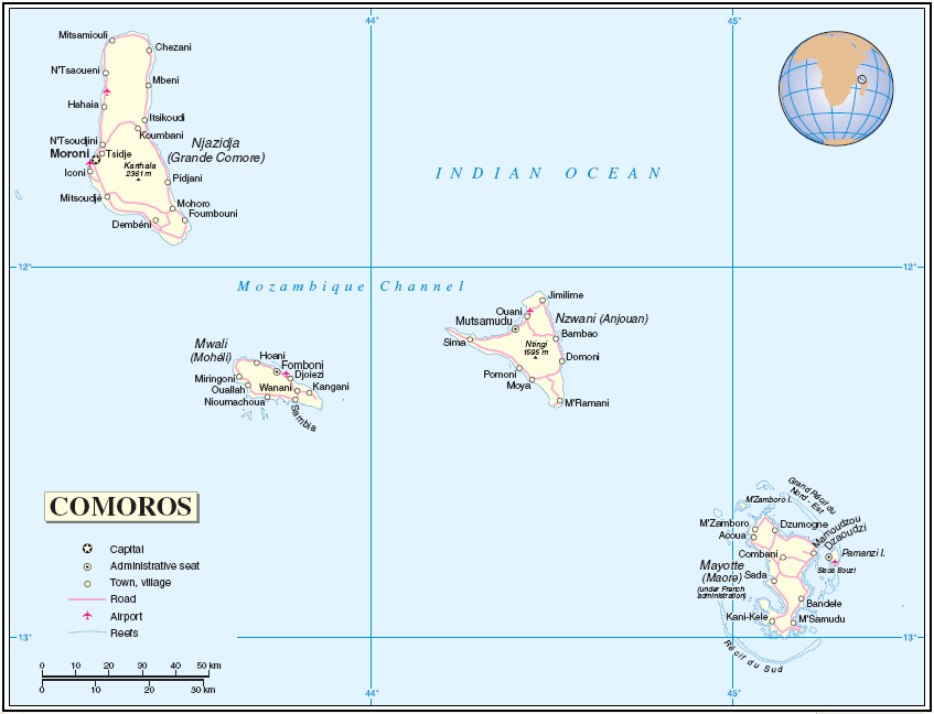
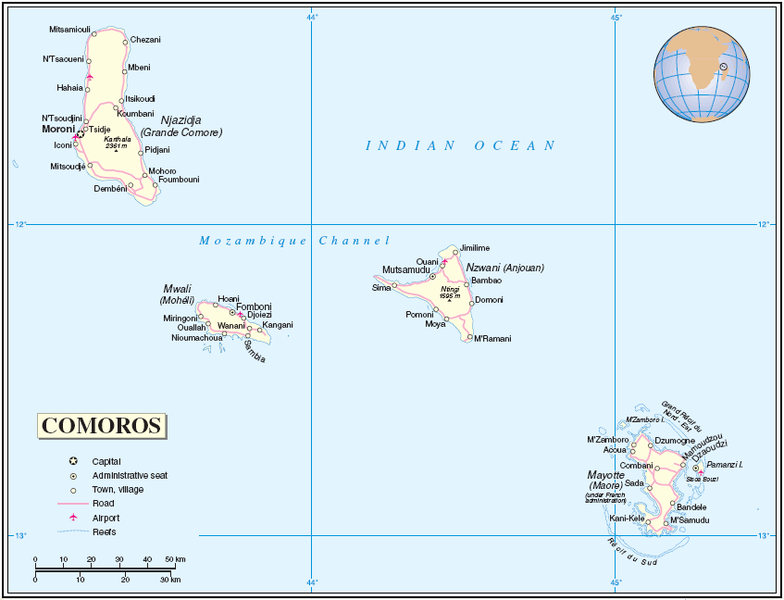
English: Map of the Comoros and Mayotte
About the maps: The United Nations cartographics section claims:
|
| Data | UTC |
| Sors | [1] |
| Awtur | Thuresson |
| This image is a map derived from a United Nations map.
Unless stated otherwise, UN maps are to be considered in the public domain. This applies worldwide. UN maps are, in principle, open source material and you can use them in your work or for making your own map. UN requests however that you delete the UN name, logo and reference number upon any modification to the map. Content of your map will be your responsibility. You can state in your publication, if you wish, something like: based on UN map … (map name, map number, revision number and date). See: Geospatial Information Section. And: Geospatial, location data for a better world. |
 |
Kronoloġija tal-fajl
Agħfas fuq il-grupp data/ħin biex tara l-fajl biex tara kif jidher dak il-ħin.
| Data/Ħin | Minjatura | Qisien | Utent | Kumment | |
|---|---|---|---|---|---|
| kurrenti | 05:04, 26 Lulju 2005 | | 847 × 648 (70 KB) | Taichi | Map of Comoros and Mayotte Source: http://www.un.org/Depts/Cartographic/map/profile/comoros.pdf About the maps: The United Nations cartographics section claims: :''Unless otherwise noted, the maps included on this web site are produced by the Cartograph |
Użu tal-fajl
Il-Paġna segwenti twassal għal din l-istampa:
L-użu globali tal-fajl
Il-wikis segwenti jużaw dan il-fajl:
- Użu fuq ar.wikipedia.org
- Użu fuq ast.wikipedia.org
- Użu fuq cbk-zam.wikipedia.org
- Użu fuq ceb.wikipedia.org
- Użu fuq eo.wikipedia.org
- Użu fuq es.wikipedia.org
- Użu fuq fi.wikipedia.org
- Użu fuq fr.wikipedia.org
- Użu fuq gl.wikipedia.org
- Użu fuq he.wikipedia.org
- Użu fuq lfn.wikipedia.org
- Użu fuq mg.wikipedia.org
- Użu fuq pt.wikipedia.org
- Użu fuq ro.wikipedia.org
- Użu fuq ru.wikipedia.org
- Użu fuq sv.wikipedia.org
- Użu fuq uk.wikipedia.org
- Użu fuq www.wikidata.org
- Użu fuq zh.wikipedia.org