Stampa:Chicago locator map.png

Daqs tad-dehra proviżorja: 570 × 600 pixels. Riżoluzzjonijiet oħra: 228 × 240 pixels | 615 × 647 pixels
Fajl oriġinali (615 × 647 pixel, dimensjoni: 406 KB, tip ta' MIME: image/png)
| Dan huwa fajl mill-Wikimedia Commons. Il-deskrizzjoni fuq il-paġna ta' diskussjoni oriġinali tidher hawn taħt.
|
Taqsira
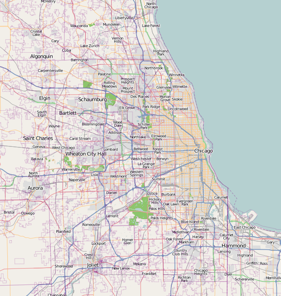
| Deskrizzjoni | A map of Chicago, IL, and the surrounding area |
| Data | |
| Sors | Base map generated by OpenStreetMap.org |
| Awtur | Dudemanfellabra |
| Permess (Użu mill-ġdid tal-fajl) |
OpenStreetMap license |
| Verżjonijiet oħra | Derivative works of this file: Chicago map LSD.png |

|
This city map image could be re-created using vector graphics as an SVG file. This has several advantages; see Commons:Media for cleanup for more information. If an SVG form of this image is available, please upload it and afterwards replace this template with
{{vector version available|new image name}}.
It is recommended to name the SVG file “Chicago locator map.svg”—then the template Vector version available (or Vva) does not need the new image name parameter. |
Liċenzja
Dan il-fajl huwa liċenzjat taħt it-termini tal-liċenzja Creative Commons Attribuzzjoni-Aqsam bl-istess mod 2.0 Ġeneriku
- Inti ħieles:
- li taqsam – li tikkopja, tiddistribwixxi u tittrażmetti din l-opra
- li timmodifika – li tadatta l-biċċa xogħol
- Taħt il-kundizzjonijiet segwenti:
- attribuzzjoni – Għandek tattribwixxi x-xogħol bil-mod speċifikat mill-awtur jew minn min ta l-l-iċenzja (imma mhux b'xi mod li jissuġġerixxi ji jappoġjaw lilek jew l-użu tax-xogħol).
- Ixxerja bl-istess mod – Jekk tbiddel, tittrasforma jew tibni fuq dan il-materjal, inti għandek bżonn taqsam il-kontribuzzjonijiet tiegħek taħt l-istess liċenzja jew waħda li taqbel ma' dik oriġinali.
Kronoloġija tal-fajl
Agħfas fuq il-grupp data/ħin biex tara l-fajl biex tara kif jidher dak il-ħin.
| Data/Ħin | Minjatura | Qisien | Utent | Kumment | |
|---|---|---|---|---|---|
| kurrenti | 18:00, 27 Frar 2017 | | 615 × 647 (406 KB) | Jeanjung212 | Lossless Compressed/optimized png decreasing file size by 59696 bytes |
| 22:49, 5 Jannar 2010 |  | 615 × 647 (464 KB) | Dudemanfellabra | {{Information |Description={{en|1=A map of Chicago, IL, and the surrounding area}} |Source={{own}} |Author=Dudemanfellabra |Date=2010-01-05 |Permission= |other_versions= }} Category:Maps of Chicago |
Użu tal-fajl
Il-Paġna segwenti twassal għal din l-istampa:
L-użu globali tal-fajl
Il-wikis segwenti jużaw dan il-fajl:
- Użu fuq af.wikipedia.org
- Użu fuq ar.wikipedia.org
- Użu fuq bn.wikipedia.org
- Użu fuq ceb.wikipedia.org
- Użu fuq en.wikipedia.org
- Fort Dearborn
- John Hancock Center
- Aon Center (Chicago)
- Saint Valentine's Day Massacre
- Navy Pier
- Alsip, Illinois
- Bartlett, Illinois
- Buffalo Grove, Illinois
- Elgin, Illinois
- Hoffman Estates, Illinois
- Olympia Fields, Illinois
- Aurora, Illinois
- Bolingbrook, Illinois
- Carol Stream, Illinois
- Naperville, Illinois
- Carpentersville, Illinois
- Joliet, Illinois
- Oswego, Illinois
- Lake Forest, Illinois
- German submarine U-505
- Northwestern University
- Field Museum of Natural History
- Symphony Center
- Garfield Park (Chicago)
- Robie House
- Mundelein College
- SeatGeek Stadium
- Willits House
- Graceland Cemetery
- Maine North High School
- Two Prudential Plaza
- 900 North Michigan
- Chase Tower (Chicago)
- Park Tower (Chicago)
- The Palmer House Hilton
- Rosehill Cemetery
- St. Ignatius College Prep
- Bryn Mawr Historic District
- Edgewater Beach Hotel
- The Levee, Chicago
- Palmer Park (Chicago)
Ara l-użu globali ta' dan il-fajl.