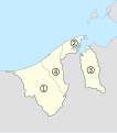
Stampa:Brunei, administrative divisions - Nmbrs (circles) - monochrome.svg

Size of this PNG preview of this SVG file: 527 × 599 pixels. Riżoluzzjonijiet oħra: 211 × 240 pixels | 422 × 480 pixels | 676 × 768 pixels | 901 × 1,024 pixels | 1,802 × 2,048 pixels | 938 × 1,066 pixels
Fajl oriġinali (Fajl fil-format SVG, dimensjoni nominali 938 × 1,066 pixel, dimensjoni tal-fajl: 110 KB)
Kronoloġija tal-fajl
Agħfas fuq il-grupp data/ħin biex tara l-fajl biex tara kif jidher dak il-ħin.
| Data/Ħin | Minjatura | Qisien | Utent | Kumment | |
|---|---|---|---|---|---|
| kurrenti | 18:11, 26 Frar 2011 |  | 938 × 1,066 (110 KB) | Tachymètre | {{Created with Inkscape}} == {{int:filedesc}} == {{Information |Description= {{en|Map of the districts of Brunei, numbered in English alphabetical order.}} {{fr|Carte des districts de Brunei, numérotés dans l'ordre alphabé |
Użu tal-fajl
Il-Paġna segwenti twassal għal din l-istampa:
L-użu globali tal-fajl
Il-wikis segwenti jużaw dan il-fajl:
- Użu fuq es.wikipedia.org
- Użu fuq fr.wikipedia.org
- Użu fuq tr.wikipedia.org
- Użu fuq zh.wikipedia.org