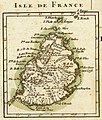
Stampa:Bonne - Isle de France (Detail).jpg

Daqs tad-dehra proviżorja: 509 × 600 pixels. Riżoluzzjonijiet oħra: 204 × 240 pixels | 407 × 480 pixels | 652 × 768 pixels | 1,045 × 1,231 pixels
Fajl oriġinali (1,045 × 1,231 pixel, dimensjoni: 388 KB, tip ta' MIME: image/jpeg)
Kronoloġija tal-fajl
Agħfas fuq il-grupp data/ħin biex tara l-fajl biex tara kif jidher dak il-ħin.
| Data/Ħin | Minjatura | Qisien | Utent | Kumment | |
|---|---|---|---|---|---|
| kurrenti | 00:53, 15 Mejju 2008 |  | 1,045 × 1,231 (388 KB) | Sting | Some cleaning |
| 22:45, 1 Marzu 2007 |  | 1,056 × 1,240 (307 KB) | Frank Schulenburg | Rigobert Bonne (1727–1795) ''Isle de France'', Nebenkarte aus: Partie de la cote orientale d’Afrique avec l’Isle de Madagascar et les cartes particulieres des Isles de France et de Bourbon. Projette et assujetie aux observati |
Użu tal-fajl
Il-Paġna segwenti twassal għal din l-istampa:
L-użu globali tal-fajl
Il-wikis segwenti jużaw dan il-fajl:
- Użu fuq ar.wikipedia.org
- Użu fuq bn.wikipedia.org
- Użu fuq ca.wikipedia.org
- Użu fuq cs.wikipedia.org
- Użu fuq da.wikipedia.org
- Użu fuq de.wikipedia.org
- Użu fuq en.wikipedia.org
- Użu fuq es.wikipedia.org
- Użu fuq fr.wikipedia.org
- Liste des colonies françaises
- Mascareignes
- Histoire de Maurice
- Expédition Baudin
- Voyage de découvertes aux terres australes
- Wikipédia:Atelier graphique/Cartes/Archives/juillet 2008
- Lys (1746)
- Alcide (1743)
- Utilisateur:Skiff/A illustrer
- Escadre Suffren dans l'océan Indien
- Campagne de l'île Maurice
- Utilisateur:Exp JC/Brouillon
- Étienne Bottineau
- Nauscopie
- Użu fuq he.wikipedia.org
- Użu fuq io.wikipedia.org
- Użu fuq nl.wikipedia.org
- Użu fuq no.wikipedia.org
- Użu fuq pt.wikipedia.org
- Użu fuq tr.wikipedia.org
- Użu fuq vec.wikipedia.org
- Użu fuq vi.wikipedia.org
- Użu fuq www.wikidata.org